W49A Belvidere, TN, USA - Earthquake Result Viewer
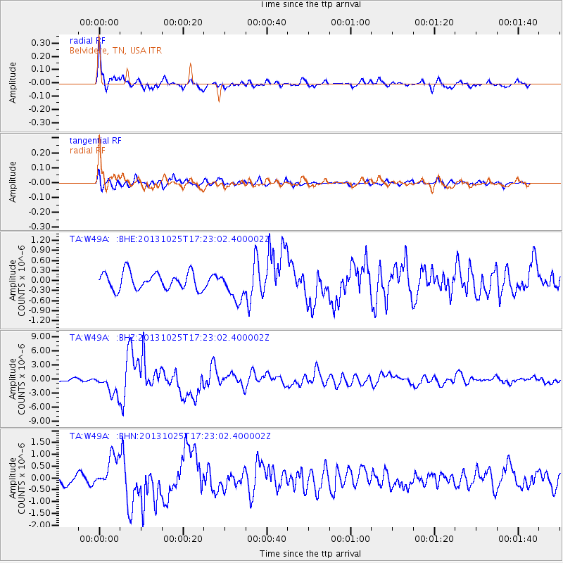
Earthquake location: Off East Coast Of Honshu, Japan
Earthquake latitude/longitude: 37.2/144.7
Earthquake time(UTC): 2013/10/25 (298) 17:10:19 GMT
Earthquake Depth: 35 km
Earthquake Magnitude: 7.1 MWW, 7.1 MWW, 7.1 MWB, 7.1 MWC, 7.2 MWC, 7.5 MI
Earthquake Catalog/Contributor: NEIC PDE/NEIC COMCAT
Network: TA USArray Transportable Network (new EarthScope stations)
Station: W49A Belvidere, TN, USA
Lat/Lon: 35.12 N/86.26 W
Elevation: 251 m
Distance: 93.9 deg
Az: 39.636 deg
Baz: 321.56 deg
Ray Param: 0.041149206
Estimated Moho Depth: 37.25 km
Estimated Crust Vp/Vs: 1.77
Assumed Crust Vp: 6.476 km/s
Estimated Crust Vs: 3.648 km/s
Estimated Crust Poisson's Ratio: 0.27
Radial Match: 85.602165 %
Radial Bump: 400
Transverse Match: 80.64885 %
Transverse Bump: 400
SOD ConfigId: 626651
Insert Time: 2014-04-19 06:19:31.482 +0000
GWidth: 2.5
Max Bumps: 400
Tol: 0.001

Signal To Noise

ChannelStoNSTALTA
TA:W49A: :BHZ:20131025T17:23:02.400002Z8.96239952.4181109E-62.6980618E-7
TA:W49A: :BHN:20131025T17:23:02.400002Z3.29543286.8869025E-72.0898324E-7
TA:W49A: :BHE:20131025T17:23:02.400002Z1.74797064.4596433E-72.5513262E-7
Arrivals
Ps4.6 SECOND
PpPs16 SECOND
PsPs/PpSs20 SECOND