W53A Cullowhee, NC, USA - Earthquake Result Viewer
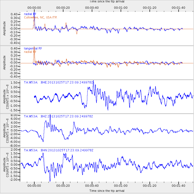
Earthquake location: Off East Coast Of Honshu, Japan
Earthquake latitude/longitude: 37.2/144.7
Earthquake time(UTC): 2013/10/25 (298) 17:10:19 GMT
Earthquake Depth: 35 km
Earthquake Magnitude: 7.1 MWW, 7.1 MWW, 7.1 MWB, 7.1 MWC, 7.2 MWC, 7.5 MI
Earthquake Catalog/Contributor: NEIC PDE/NEIC COMCAT
Network: TA USArray Transportable Network (new EarthScope stations)
Station: W53A Cullowhee, NC, USA
Lat/Lon: 35.17 N/83.16 W
Elevation: 1180 m
Distance: 95.4 deg
Az: 37.581 deg
Baz: 323.505 deg
Ray Param: 0.040768906
Estimated Moho Depth: 49.5 km
Estimated Crust Vp/Vs: 1.94
Assumed Crust Vp: 6.35 km/s
Estimated Crust Vs: 3.277 km/s
Estimated Crust Poisson's Ratio: 0.32
Radial Match: 93.71746 %
Radial Bump: 400
Transverse Match: 61.99984 %
Transverse Bump: 400
SOD ConfigId: 626651
Insert Time: 2014-04-19 06:19:41.651 +0000
GWidth: 2.5
Max Bumps: 400
Tol: 0.001

Signal To Noise

ChannelStoNSTALTA
TA:W53A: :BHZ:20131025T17:23:09.249978Z12.54237651.7825907E-61.4212544E-7
TA:W53A: :BHN:20131025T17:23:09.249978Z3.3847195.8948245E-71.7415994E-7
TA:W53A: :BHE:20131025T17:23:09.249978Z1.88510114.838717E-72.5668209E-7
Arrivals
Ps7.4 SECOND
PpPs22 SECOND
PsPs/PpSs30 SECOND