X48A Hartselle, AL, USA - Earthquake Result Viewer
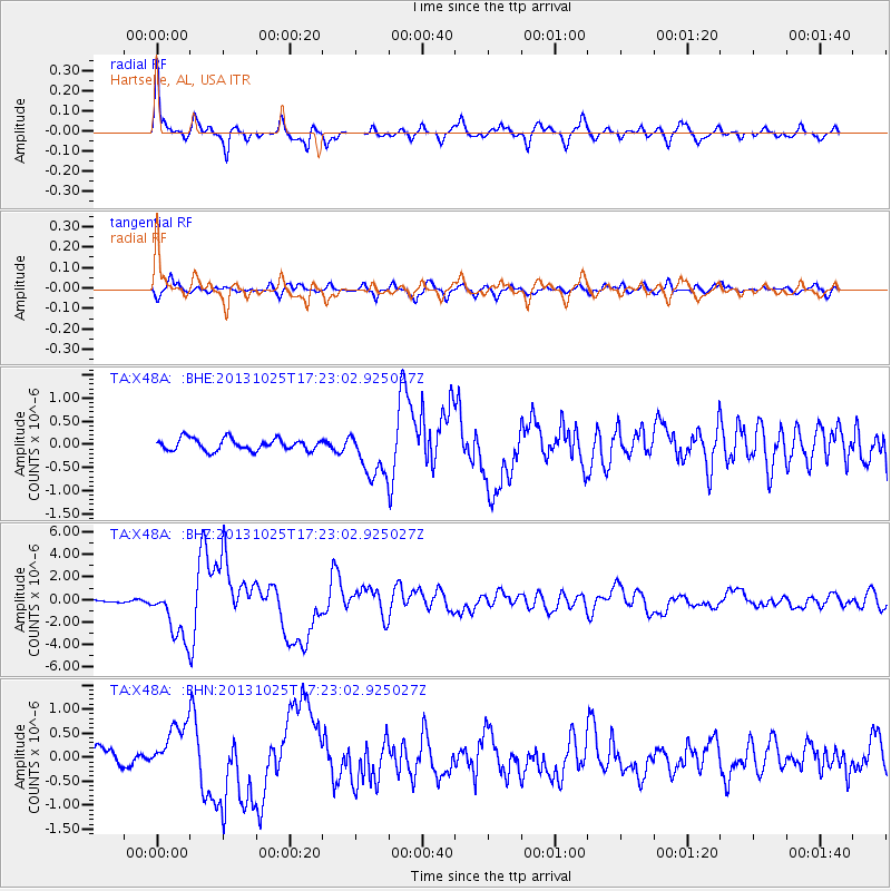
Earthquake location: Off East Coast Of Honshu, Japan
Earthquake latitude/longitude: 37.2/144.7
Earthquake time(UTC): 2013/10/25 (298) 17:10:19 GMT
Earthquake Depth: 35 km
Earthquake Magnitude: 7.1 MWW, 7.1 MWW, 7.1 MWB, 7.1 MWC, 7.2 MWC, 7.5 MI
Earthquake Catalog/Contributor: NEIC PDE/NEIC COMCAT
Network: TA USArray Transportable Network (new EarthScope stations)
Station: X48A Hartselle, AL, USA
Lat/Lon: 34.45 N/87.05 W
Elevation: 180 m
Distance: 94.0 deg
Az: 40.556 deg
Baz: 321.052 deg
Ray Param: 0.041122448
Estimated Moho Depth: 16.75 km
Estimated Crust Vp/Vs: 2.08
Assumed Crust Vp: 6.476 km/s
Estimated Crust Vs: 3.117 km/s
Estimated Crust Poisson's Ratio: 0.35
Radial Match: 87.30837 %
Radial Bump: 400
Transverse Match: 81.000404 %
Transverse Bump: 400
SOD ConfigId: 626651
Insert Time: 2014-04-19 06:20:07.492 +0000
GWidth: 2.5
Max Bumps: 400
Tol: 0.001

Signal To Noise

ChannelStoNSTALTA
TA:X48A: :BHZ:20131025T17:23:02.925027Z15.6273442.3930525E-61.5313239E-7
TA:X48A: :BHN:20131025T17:23:02.925027Z2.24751785.0512887E-72.2474967E-7
TA:X48A: :BHE:20131025T17:23:02.925027Z4.0264625.1402935E-71.2766279E-7
Arrivals
Ps2.8 SECOND
PpPs7.8 SECOND
PsPs/PpSs11 SECOND