X54A Belton, SC, USA - Earthquake Result Viewer
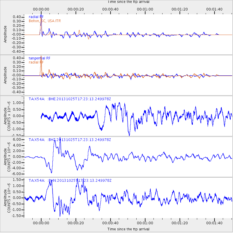
Earthquake location: Off East Coast Of Honshu, Japan
Earthquake latitude/longitude: 37.2/144.7
Earthquake time(UTC): 2013/10/25 (298) 17:10:19 GMT
Earthquake Depth: 35 km
Earthquake Magnitude: 7.1 MWW, 7.1 MWW, 7.1 MWB, 7.1 MWC, 7.2 MWC, 7.5 MI
Earthquake Catalog/Contributor: NEIC PDE/NEIC COMCAT
Network: TA USArray Transportable Network (new EarthScope stations)
Station: X54A Belton, SC, USA
Lat/Lon: 34.55 N/82.37 W
Elevation: 213 m
Distance: 96.3 deg
Az: 37.424 deg
Baz: 323.97 deg
Ray Param: 0.040534202
Estimated Moho Depth: 47.5 km
Estimated Crust Vp/Vs: 1.60
Assumed Crust Vp: 6.35 km/s
Estimated Crust Vs: 3.969 km/s
Estimated Crust Poisson's Ratio: 0.18
Radial Match: 91.93145 %
Radial Bump: 400
Transverse Match: 79.39788 %
Transverse Bump: 400
SOD ConfigId: 626651
Insert Time: 2014-04-19 06:20:17.295 +0000
GWidth: 2.5
Max Bumps: 400
Tol: 0.001

Signal To Noise

ChannelStoNSTALTA
TA:X54A: :BHZ:20131025T17:23:13.249978Z16.0689771.6652796E-61.036332E-7
TA:X54A: :BHN:20131025T17:23:13.249978Z3.8758945.337629E-71.3771349E-7
TA:X54A: :BHE:20131025T17:23:13.249978Z2.66494684.7958133E-71.7995907E-7
Arrivals
Ps4.6 SECOND
PpPs19 SECOND
PsPs/PpSs24 SECOND