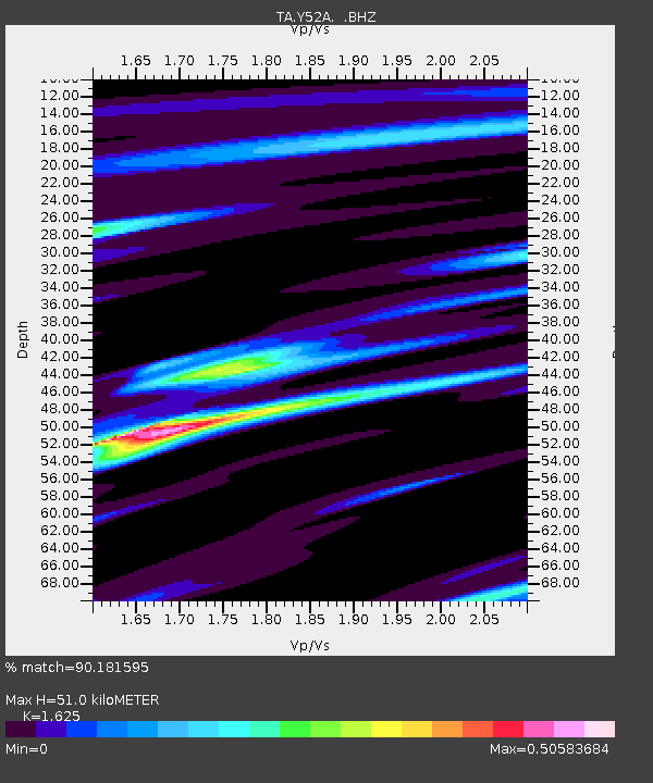
Y52A Lilburn, GA, USA - Earthquake Result Viewer
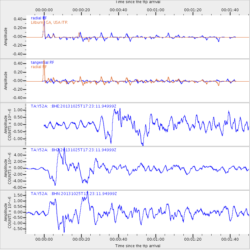
Earthquake location: Off East Coast Of Honshu, Japan
Earthquake latitude/longitude: 37.2/144.7
Earthquake time(UTC): 2013/10/25 (298) 17:10:19 GMT
Earthquake Depth: 35 km
Earthquake Magnitude: 7.1 MWW, 7.1 MWW, 7.1 MWB, 7.1 MWC, 7.2 MWC, 7.5 MI
Earthquake Catalog/Contributor: NEIC PDE/NEIC COMCAT
Network: TA USArray Transportable Network (new EarthScope stations)
Station: Y52A Lilburn, GA, USA
Lat/Lon: 33.86 N/84.06 W
Elevation: 286 m
Distance: 96.0 deg
Az: 38.963 deg
Baz: 322.859 deg
Ray Param: 0.040610295
Estimated Moho Depth: 51.0 km
Estimated Crust Vp/Vs: 1.62
Assumed Crust Vp: 6.719 km/s
Estimated Crust Vs: 4.135 km/s
Estimated Crust Poisson's Ratio: 0.20
Radial Match: 90.181595 %
Radial Bump: 329
Transverse Match: 66.006 %
Transverse Bump: 400
SOD ConfigId: 626651
Insert Time: 2014-04-19 06:20:40.540 +0000
GWidth: 2.5
Max Bumps: 400
Tol: 0.001

Signal To Noise

ChannelStoNSTALTA
TA:Y52A: :BHZ:20131025T17:23:11.94999Z10.2633761.7734841E-61.7279733E-7
TA:Y52A: :BHN:20131025T17:23:11.94999Z3.30687835.249096E-71.5873266E-7
TA:Y52A: :BHE:20131025T17:23:11.94999Z3.73511935.396488E-71.4447967E-7
Arrivals
Ps4.9 SECOND
PpPs19 SECOND
PsPs/PpSs24 SECOND