
Y56A Pelion, SC, USA - Earthquake Result Viewer
| ||||||||||||||||||
| ||||||||||||||||||
| ||||||||||||||||||
|
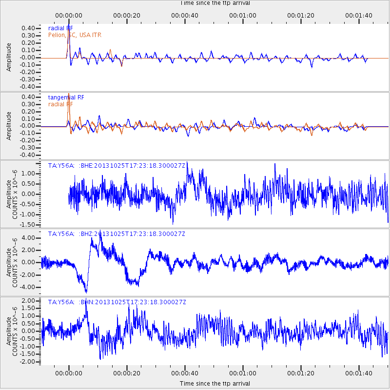
Signal To Noise
| Channel | StoN | STA | LTA |
| TA:Y56A: :BHZ:20131025T17:23:18.300027Z | 2.6898208 | 1.5370557E-6 | 5.7143427E-7 |
| TA:Y56A: :BHN:20131025T17:23:18.300027Z | 1.1201518 | 3.9086015E-7 | 3.48935E-7 |
| TA:Y56A: :BHE:20131025T17:23:18.300027Z | 0.99350655 | 3.6602512E-7 | 3.684174E-7 |
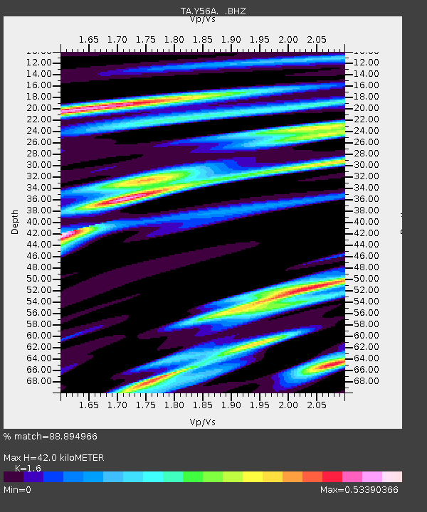
| Arrivals | |
| Ps | 3.9 SECOND |
| PpPs | 16 SECOND |
| PsPs/PpSs | 20 SECOND |

