
BOZ Bozeman, Montana, USA - Earthquake Result Viewer
| ||||||||||||||||||
| ||||||||||||||||||
| ||||||||||||||||||
|
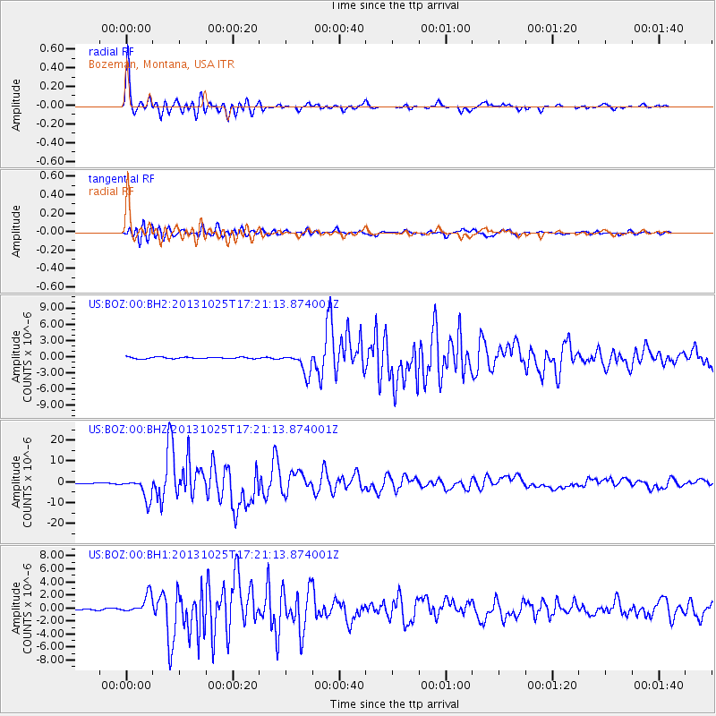
Signal To Noise
| Channel | StoN | STA | LTA |
| US:BOZ:00:BHZ:20131025T17:21:13.874001Z | 28.87278 | 5.3030462E-6 | 1.836694E-7 |
| US:BOZ:00:BH1:20131025T17:21:13.874001Z | 10.419533 | 1.473311E-6 | 1.4139896E-7 |
| US:BOZ:00:BH2:20131025T17:21:13.874001Z | 14.459056 | 2.0098332E-6 | 1.390017E-7 |
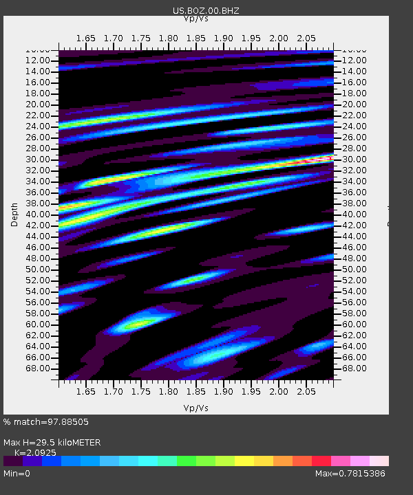
| Arrivals | |
| Ps | 5.2 SECOND |
| PpPs | 14 SECOND |
| PsPs/PpSs | 19 SECOND |

