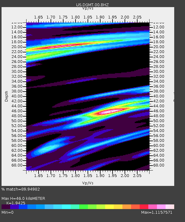
DGMT Dagmar, Montana, USA - Earthquake Result Viewer
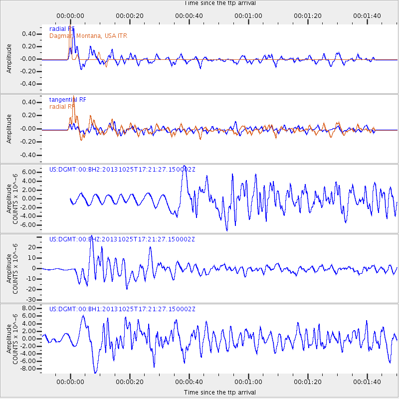
Earthquake location: Off East Coast Of Honshu, Japan
Earthquake latitude/longitude: 37.2/144.7
Earthquake time(UTC): 2013/10/25 (298) 17:10:19 GMT
Earthquake Depth: 35 km
Earthquake Magnitude: 7.1 MWW, 7.1 MWW, 7.1 MWB, 7.1 MWC, 7.2 MWC, 7.5 MI
Earthquake Catalog/Contributor: NEIC PDE/NEIC COMCAT
Network: US United States National Seismic Network
Station: DGMT Dagmar, Montana, USA
Lat/Lon: 48.47 N/104.20 W
Elevation: 0.0 m
Distance: 75.1 deg
Az: 39.963 deg
Baz: 309.549 deg
Ray Param: 0.05184099
Estimated Moho Depth: 46.0 km
Estimated Crust Vp/Vs: 1.94
Assumed Crust Vp: 6.438 km/s
Estimated Crust Vs: 3.314 km/s
Estimated Crust Poisson's Ratio: 0.32
Radial Match: 89.94982 %
Radial Bump: 400
Transverse Match: 77.892075 %
Transverse Bump: 400
SOD ConfigId: 626651
Insert Time: 2014-04-19 06:22:17.331 +0000
GWidth: 2.5
Max Bumps: 400
Tol: 0.001

Signal To Noise

ChannelStoNSTALTA
US:DGMT:00:BHZ:20131025T17:21:27.150002Z15.17128855.8446376E-63.8524334E-7
US:DGMT:00:BH1:20131025T17:21:27.150002Z2.9197682.9977352E-61.0267032E-6
US:DGMT:00:BH2:20131025T17:21:27.150002Z2.15756461.7705248E-68.206127E-7
Arrivals
Ps6.9 SECOND
PpPs20 SECOND
PsPs/PpSs27 SECOND