ERPA Erie, Pennsylvania, USA - Earthquake Result Viewer
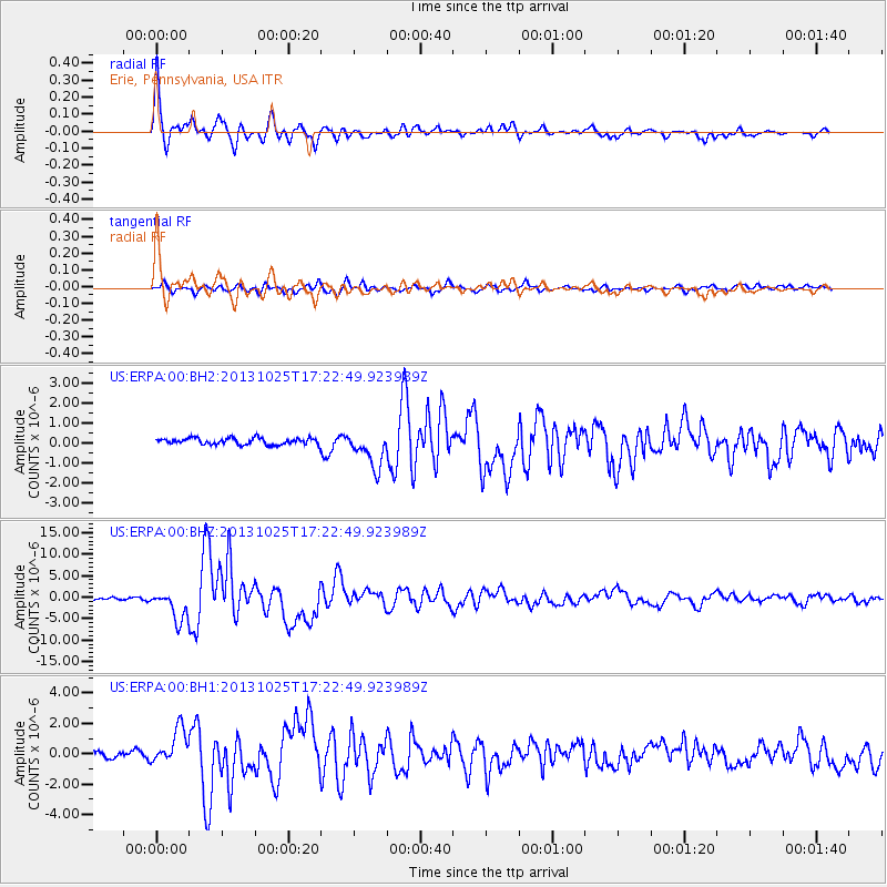
Earthquake location: Off East Coast Of Honshu, Japan
Earthquake latitude/longitude: 37.2/144.7
Earthquake time(UTC): 2013/10/25 (298) 17:10:19 GMT
Earthquake Depth: 35 km
Earthquake Magnitude: 7.1 MWW, 7.1 MWW, 7.1 MWB, 7.1 MWC, 7.2 MWC, 7.5 MI
Earthquake Catalog/Contributor: NEIC PDE/NEIC COMCAT
Network: US United States National Seismic Network
Station: ERPA Erie, Pennsylvania, USA
Lat/Lon: 42.12 N/79.99 W
Elevation: 306 m
Distance: 91.2 deg
Az: 31.533 deg
Baz: 325.833 deg
Ray Param: 0.041614316
Estimated Moho Depth: 22.75 km
Estimated Crust Vp/Vs: 1.71
Assumed Crust Vp: 6.419 km/s
Estimated Crust Vs: 3.759 km/s
Estimated Crust Poisson's Ratio: 0.24
Radial Match: 94.84456 %
Radial Bump: 380
Transverse Match: 76.81484 %
Transverse Bump: 400
SOD ConfigId: 626651
Insert Time: 2014-04-19 06:22:32.636 +0000
GWidth: 2.5
Max Bumps: 400
Tol: 0.001

Signal To Noise

ChannelStoNSTALTA
US:ERPA:00:BHZ:20131025T17:22:49.923989Z13.9737463.4451505E-62.4654452E-7
US:ERPA:00:BH1:20131025T17:22:49.923989Z3.59344031.143296E-63.1816197E-7
US:ERPA:00:BH2:20131025T17:22:49.923989Z5.6671529.079627E-71.60215E-7
Arrivals
Ps2.6 SECOND
PpPs9.4 SECOND
PsPs/PpSs12 SECOND