WMOK Wichita Mountains, Oklahoma, USA - Earthquake Result Viewer
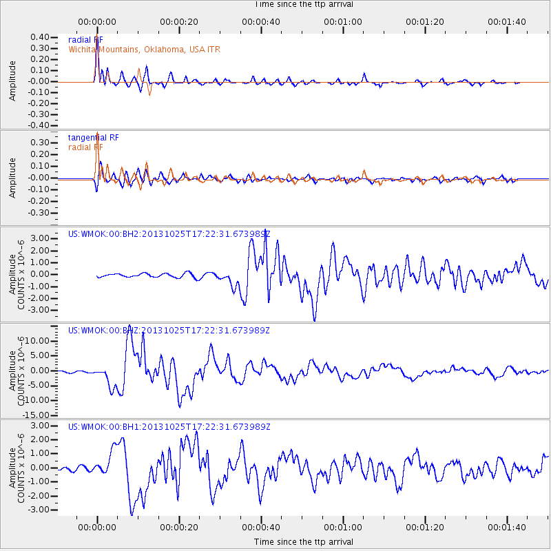
Earthquake location: Off East Coast Of Honshu, Japan
Earthquake latitude/longitude: 37.2/144.7
Earthquake time(UTC): 2013/10/25 (298) 17:10:19 GMT
Earthquake Depth: 35 km
Earthquake Magnitude: 7.1 MWW, 7.1 MWW, 7.1 MWB, 7.1 MWC, 7.2 MWC, 7.5 MI
Earthquake Catalog/Contributor: NEIC PDE/NEIC COMCAT
Network: US United States National Seismic Network
Station: WMOK Wichita Mountains, Oklahoma, USA
Lat/Lon: 34.74 N/98.78 W
Elevation: 486 m
Distance: 87.3 deg
Az: 47.516 deg
Baz: 314.321 deg
Ray Param: 0.0433716
Estimated Moho Depth: 51.25 km
Estimated Crust Vp/Vs: 1.73
Assumed Crust Vp: 6.315 km/s
Estimated Crust Vs: 3.645 km/s
Estimated Crust Poisson's Ratio: 0.25
Radial Match: 97.51341 %
Radial Bump: 367
Transverse Match: 90.39822 %
Transverse Bump: 400
SOD ConfigId: 626651
Insert Time: 2014-04-19 06:23:49.899 +0000
GWidth: 2.5
Max Bumps: 400
Tol: 0.001

Signal To Noise

ChannelStoNSTALTA
US:WMOK:00:BHZ:20131025T17:22:31.673989Z15.4086213.6632914E-62.3774298E-7
US:WMOK:00:BH1:20131025T17:22:31.673989Z5.2197249.5343495E-71.8266002E-7
US:WMOK:00:BH2:20131025T17:22:31.673989Z4.00563056.8149853E-71.7013515E-7
Arrivals
Ps6.1 SECOND
PpPs22 SECOND
PsPs/PpSs28 SECOND