WRAK Wrangell Island, Southeastern Alaska, Alaska, USA - Earthquake Result Viewer
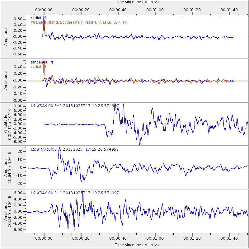
Earthquake location: Off East Coast Of Honshu, Japan
Earthquake latitude/longitude: 37.2/144.7
Earthquake time(UTC): 2013/10/25 (298) 17:10:19 GMT
Earthquake Depth: 35 km
Earthquake Magnitude: 7.1 MWW, 7.1 MWW, 7.1 MWB, 7.1 MWC, 7.2 MWC, 7.5 MI
Earthquake Catalog/Contributor: NEIC PDE/NEIC COMCAT
Network: US United States National Seismic Network
Station: WRAK Wrangell Island, Southeastern Alaska, Alaska, USA
Lat/Lon: 56.42 N/132.35 W
Elevation: 81 m
Distance: 56.3 deg
Az: 41.498 deg
Baz: 287.706 deg
Ray Param: 0.064137176
Estimated Moho Depth: 27.75 km
Estimated Crust Vp/Vs: 1.99
Assumed Crust Vp: 6.597 km/s
Estimated Crust Vs: 3.319 km/s
Estimated Crust Poisson's Ratio: 0.33
Radial Match: 96.578445 %
Radial Bump: 400
Transverse Match: 86.03511 %
Transverse Bump: 400
SOD ConfigId: 626651
Insert Time: 2014-04-19 06:23:54.771 +0000
GWidth: 2.5
Max Bumps: 400
Tol: 0.001

Signal To Noise

ChannelStoNSTALTA
US:WRAK:00:BHZ:20131025T17:19:26.57499Z30.5203515.13054E-61.6810226E-7
US:WRAK:00:BH1:20131025T17:19:26.57499Z6.0251861.0258592E-61.7026184E-7
US:WRAK:00:BH2:20131025T17:19:26.57499Z14.9232232.1874118E-61.465777E-7
Arrivals
Ps4.4 SECOND
PpPs12 SECOND
PsPs/PpSs16 SECOND