CCUT Cedar City, UT, USA - Earthquake Result Viewer
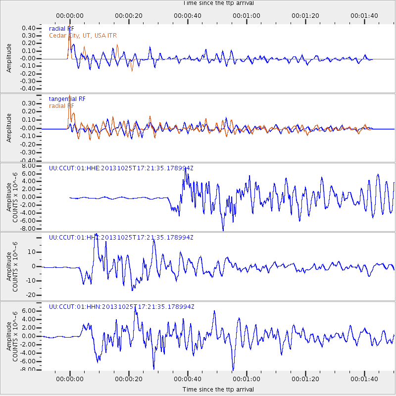
Earthquake location: Off East Coast Of Honshu, Japan
Earthquake latitude/longitude: 37.2/144.7
Earthquake time(UTC): 2013/10/25 (298) 17:10:19 GMT
Earthquake Depth: 35 km
Earthquake Magnitude: 7.1 MWW, 7.1 MWW, 7.1 MWB, 7.1 MWC, 7.2 MWC, 7.5 MI
Earthquake Catalog/Contributor: NEIC PDE/NEIC COMCAT
Network: UU University of Utah Regional Network
Station: CCUT Cedar City, UT, USA
Lat/Lon: 37.55 N/113.36 W
Elevation: 2127 m
Distance: 76.5 deg
Az: 53.086 deg
Baz: 306.513 deg
Ray Param: 0.05089293
Estimated Moho Depth: 14.0 km
Estimated Crust Vp/Vs: 1.61
Assumed Crust Vp: 6.194 km/s
Estimated Crust Vs: 3.853 km/s
Estimated Crust Poisson's Ratio: 0.18
Radial Match: 95.57039 %
Radial Bump: 400
Transverse Match: 91.29301 %
Transverse Bump: 400
SOD ConfigId: 626651
Insert Time: 2014-04-19 06:24:06.165 +0000
GWidth: 2.5
Max Bumps: 400
Tol: 0.001

Signal To Noise

ChannelStoNSTALTA
UU:CCUT:01:HHZ:20131025T17:21:35.178994Z39.4853484.0349214E-61.02187805E-7
UU:CCUT:01:HHN:20131025T17:21:35.178994Z3.33205639.470885E-72.8423543E-7
UU:CCUT:01:HHE:20131025T17:21:35.178994Z7.07759149.783554E-71.3823282E-7
Arrivals
Ps1.4 SECOND
PpPs5.7 SECOND
PsPs/PpSs7.1 SECOND