CVRU Castle Valley Ranch, Emery, UT, USA old TA-Q16A - Earthquake Result Viewer
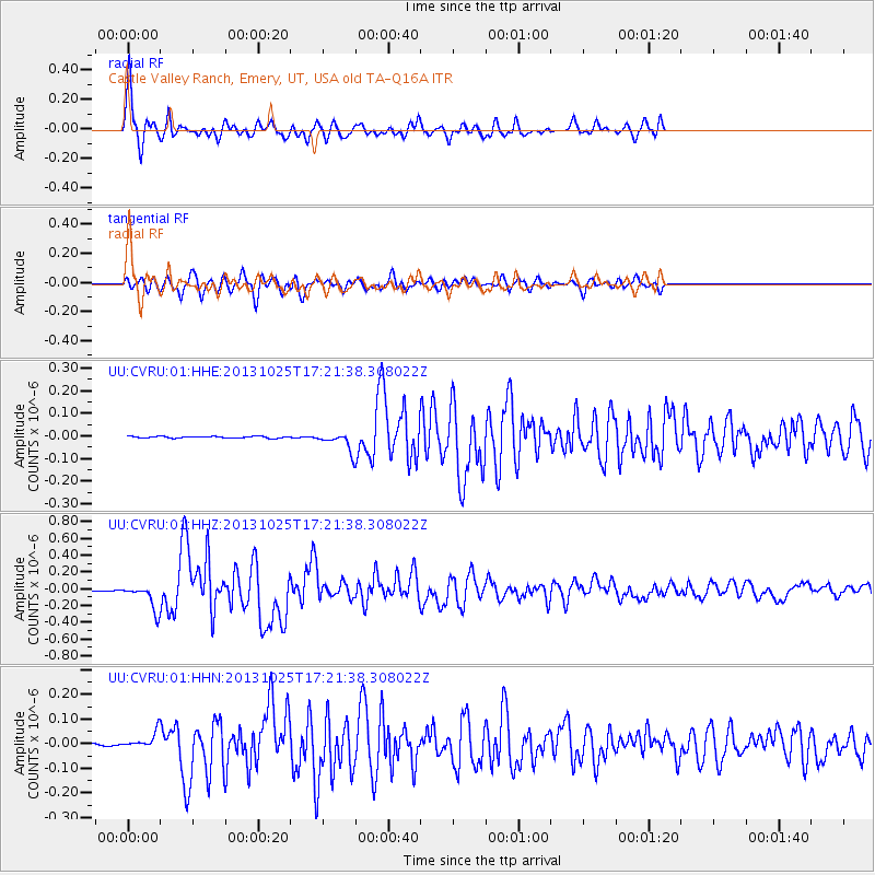
Earthquake location: Off East Coast Of Honshu, Japan
Earthquake latitude/longitude: 37.2/144.7
Earthquake time(UTC): 2013/10/25 (298) 17:10:19 GMT
Earthquake Depth: 35 km
Earthquake Magnitude: 7.1 MWW, 7.1 MWW, 7.1 MWB, 7.1 MWC, 7.2 MWC, 7.5 MI
Earthquake Catalog/Contributor: NEIC PDE/NEIC COMCAT
Network: UU University of Utah Regional Network
Station: CVRU Castle Valley Ranch, Emery, UT, USA old TA-Q16A
Lat/Lon: 38.92 N/111.17 W
Elevation: 1912 m
Distance: 77.1 deg
Az: 50.9 deg
Baz: 307.365 deg
Ray Param: 0.05051894
Estimated Moho Depth: 48.75 km
Estimated Crust Vp/Vs: 1.79
Assumed Crust Vp: 6.207 km/s
Estimated Crust Vs: 3.472 km/s
Estimated Crust Poisson's Ratio: 0.27
Radial Match: 93.35891 %
Radial Bump: 400
Transverse Match: 82.644394 %
Transverse Bump: 400
SOD ConfigId: 626651
Insert Time: 2014-04-19 06:24:08.015 +0000
GWidth: 2.5
Max Bumps: 400
Tol: 0.001

Signal To Noise

ChannelStoNSTALTA
UU:CVRU:01:HHZ:20131025T17:21:38.308022Z48.7631451.4837951E-73.0428617E-9
UU:CVRU:01:HHN:20131025T17:21:38.308022Z4.9664133.0970853E-86.23606E-9
UU:CVRU:01:HHE:20131025T17:21:38.308022Z10.3834343.8839783E-83.7405528E-9
Arrivals
Ps6.4 SECOND
PpPs21 SECOND
PsPs/PpSs28 SECOND