
HEBO Mt. Hebo, OR CREST BB SMO - Earthquake Result Viewer
| ||||||||||||||||||
| ||||||||||||||||||
| ||||||||||||||||||
|
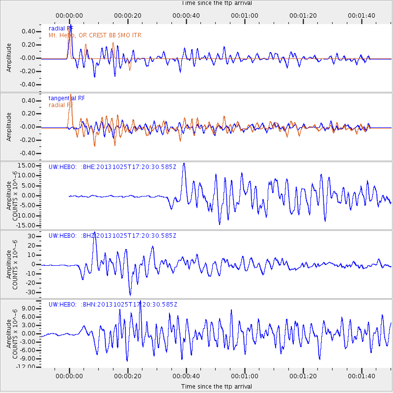
Signal To Noise
| Channel | StoN | STA | LTA |
| UW:HEBO: :BHZ:20131025T17:20:30.585Z | 25.83139 | 5.560639E-6 | 2.1526672E-7 |
| UW:HEBO: :BHN:20131025T17:20:30.585Z | 3.4952774 | 9.571506E-7 | 2.7384112E-7 |
| UW:HEBO: :BHE:20131025T17:20:30.585Z | 7.0268784 | 1.8085627E-6 | 2.5737782E-7 |
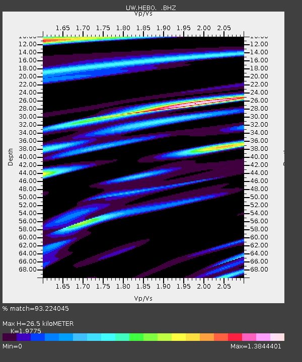
| Arrivals | |
| Ps | 4.1 SECOND |
| PpPs | 12 SECOND |
| PsPs/PpSs | 16 SECOND |

