HOOD Mt Hood Meadows, OR CREST BB SMO - Earthquake Result Viewer
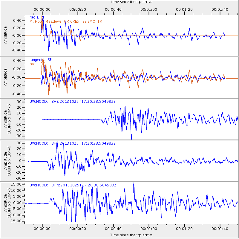
Earthquake location: Off East Coast Of Honshu, Japan
Earthquake latitude/longitude: 37.2/144.7
Earthquake time(UTC): 2013/10/25 (298) 17:10:19 GMT
Earthquake Depth: 35 km
Earthquake Magnitude: 7.1 MWW, 7.1 MWW, 7.1 MWB, 7.1 MWC, 7.2 MWC, 7.5 MI
Earthquake Catalog/Contributor: NEIC PDE/NEIC COMCAT
Network: UW Pacific Northwest Regional Seismic Network
Station: HOOD Mt Hood Meadows, OR CREST BB SMO
Lat/Lon: 45.32 N/121.65 W
Elevation: 1520 m
Distance: 67.0 deg
Az: 49.871 deg
Baz: 300.02 deg
Ray Param: 0.05715531
Estimated Moho Depth: 18.0 km
Estimated Crust Vp/Vs: 1.79
Assumed Crust Vp: 6.597 km/s
Estimated Crust Vs: 3.686 km/s
Estimated Crust Poisson's Ratio: 0.27
Radial Match: 92.32502 %
Radial Bump: 400
Transverse Match: 85.24946 %
Transverse Bump: 400
SOD ConfigId: 626651
Insert Time: 2014-04-19 06:25:29.315 +0000
GWidth: 2.5
Max Bumps: 400
Tol: 0.001

Signal To Noise

ChannelStoNSTALTA
UW:HOOD: :BHZ:20131025T17:20:38.504983Z54.769265.6998406E-61.0407007E-7
UW:HOOD: :BHN:20131025T17:20:38.504983Z5.7028411.0823007E-61.8978274E-7
UW:HOOD: :BHE:20131025T17:20:38.504983Z18.0244922.2161985E-61.2295483E-7
Arrivals
Ps2.2 SECOND
PpPs7.3 SECOND
PsPs/PpSs9.5 SECOND