
LEBA Lebam, WA, USA - Earthquake Result Viewer
| ||||||||||||||||||
| ||||||||||||||||||
| ||||||||||||||||||
|
Signal To Noise
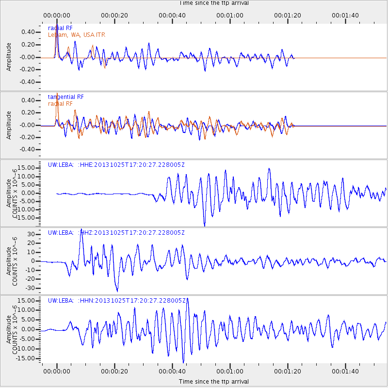
| Channel | StoN | STA | LTA |
| UW:LEBA: :HHZ:20131025T17:20:27.228005Z | 27.919983 | 5.7910947E-6 | 2.0741756E-7 |
| UW:LEBA: :HHN:20131025T17:20:27.228005Z | 5.842642 | 1.4137977E-6 | 2.419792E-7 |
| UW:LEBA: :HHE:20131025T17:20:27.228005Z | 7.3061495 | 1.6732458E-6 | 2.2901885E-7 |
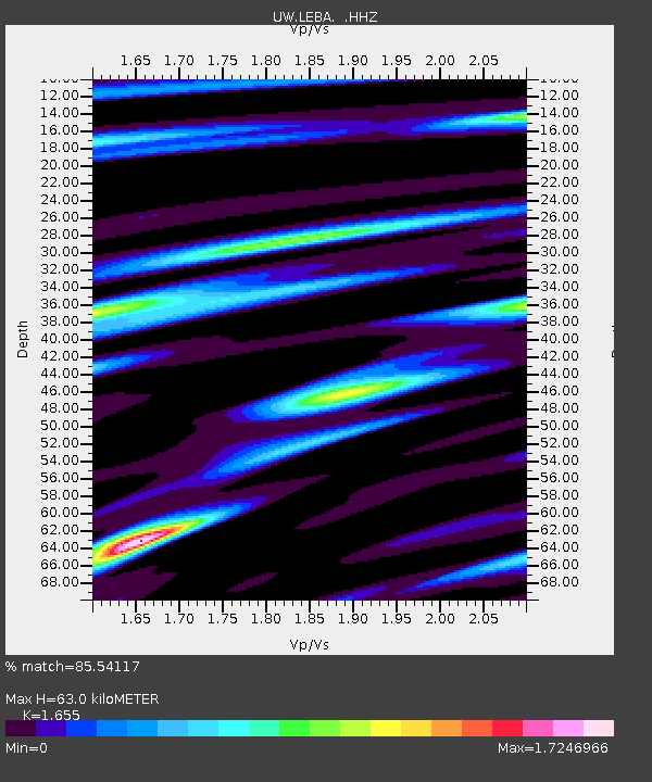
| Arrivals | |
| Ps | 6.6 SECOND |
| PpPs | 24 SECOND |
| PsPs/PpSs | 31 SECOND |

