You are here: Home > Network List > TA - USArray Transportable Network (new EarthScope stations) Stations List
> Station O48A Farmland, IN, USA > Earthquake Result Viewer
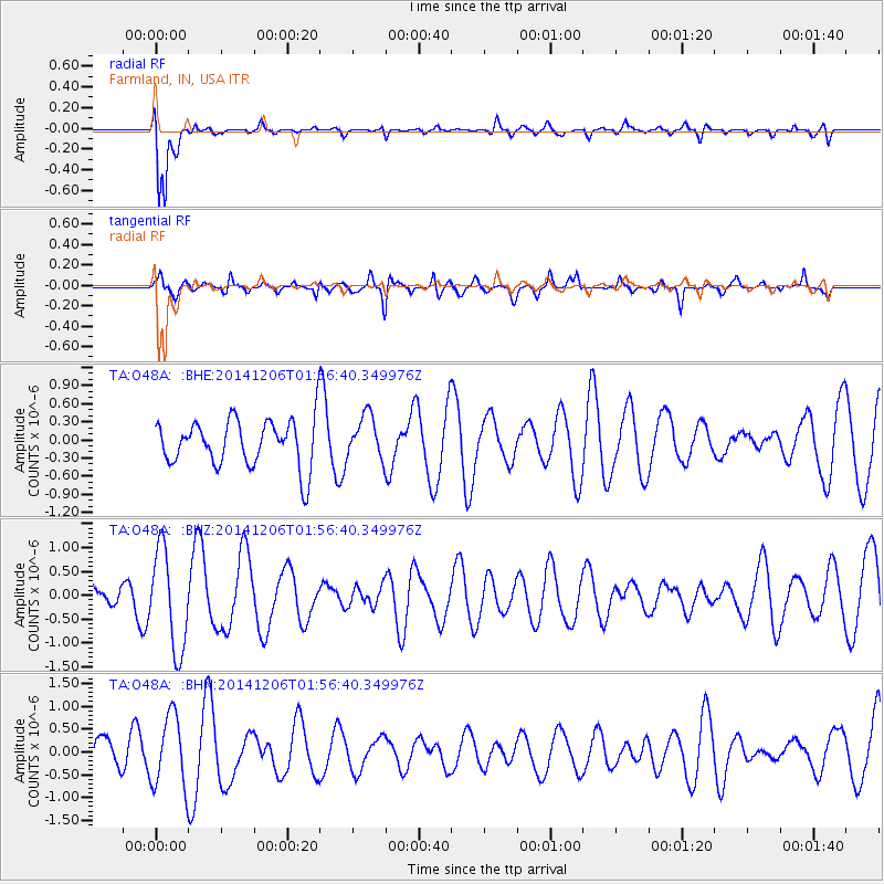
O48A Farmland, IN, USA - Earthquake Result Viewer
*The percent match for this event was below the threshold and hence no stack was calculated.
| Earthquake location: |
Aegean Sea |
| Earthquake latitude/longitude: |
39.0/26.3 |
| Earthquake time(UTC): |
2014/12/06 (340) 01:45:07 GMT |
| Earthquake Depth: |
16 km |
| Earthquake Magnitude: |
5.1 MW, 5.3 mb, 4.4 MS |
| Earthquake Catalog/Contributor: |
ISC/ISC |
|
| Network: |
TA USArray Transportable Network (new EarthScope stations) |
| Station: |
O48A Farmland, IN, USA |
| Lat/Lon: |
40.26 N/85.16 W |
| Elevation: |
300 m |
|
| Distance: |
79.3 deg |
| Az: |
313.537 deg |
| Baz: |
47.578 deg |
| Ray Param: |
$rayparam |
*The percent match for this event was below the threshold and hence was not used in the summary stack. |
|
| Radial Match: |
77.599724 % |
| Radial Bump: |
400 |
| Transverse Match: |
49.760426 % |
| Transverse Bump: |
400 |
| SOD ConfigId: |
3390531 |
| Insert Time: |
2019-04-15 09:17:23.661 +0000 |
| GWidth: |
2.5 |
| Max Bumps: |
400 |
| Tol: |
0.001 |
|
Signal To Noise
| Channel | StoN | STA | LTA |
| TA:O48A: :BHZ:20141206T01:56:40.349976Z | 3.994381 | 1.0399953E-6 | 2.6036454E-7 |
| TA:O48A: :BHN:20141206T01:56:40.349976Z | 2.0513482 | 7.855516E-7 | 3.8294405E-7 |
| TA:O48A: :BHE:20141206T01:56:40.349976Z | 0.9221503 | 3.579238E-7 | 3.8814042E-7 |
| Arrivals |
| Ps | |
| PpPs | |
| PsPs/PpSs | |


