You are here: Home > Network List > TA - USArray Transportable Network (new EarthScope stations) Stations List
> Station G59A Clarenceville, QC, USA > Earthquake Result Viewer
G59A Clarenceville, QC, USA - Earthquake Result Viewer
*The percent match for this event was below the threshold and hence no stack was calculated.
| Earthquake location: |
Off East Coast Of Honshu, Japan |
| Earthquake latitude/longitude: |
37.1/144.7 |
| Earthquake time(UTC): |
2013/10/25 (298) 21:27:34 GMT |
| Earthquake Depth: |
10 km |
| Earthquake Magnitude: |
5.5 MB, 5.8 MWC |
| Earthquake Catalog/Contributor: |
NEIC PDE/NEIC COMCAT |
|
| Network: |
TA USArray Transportable Network (new EarthScope stations) |
| Station: |
G59A Clarenceville, QC, USA |
| Lat/Lon: |
45.08 N/73.18 W |
| Elevation: |
36 m |
|
| Distance: |
91.3 deg |
| Az: |
25.777 deg |
| Baz: |
330.613 deg |
| Ray Param: |
$rayparam |
*The percent match for this event was below the threshold and hence was not used in the summary stack. |
|
| Radial Match: |
56.007435 % |
| Radial Bump: |
400 |
| Transverse Match: |
51.074574 % |
| Transverse Bump: |
400 |
| SOD ConfigId: |
626651 |
| Insert Time: |
2014-04-19 07:03:03.700 +0000 |
| GWidth: |
2.5 |
| Max Bumps: |
400 |
| Tol: |
0.001 |
|
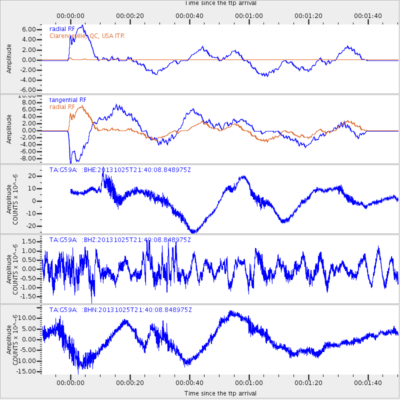
Signal To Noise
| Channel | StoN | STA | LTA |
| TA:G59A: :BHZ:20131025T21:40:08.848975Z | 0.6510458 | 5.2738534E-7 | 8.100588E-7 |
| TA:G59A: :BHN:20131025T21:40:08.848975Z | 2.5287817 | 9.090916E-6 | 3.5949786E-6 |
| TA:G59A: :BHE:20131025T21:40:08.848975Z | 2.0974517 | 9.670364E-6 | 4.61053E-6 |
| Arrivals |
| Ps | |
| PpPs | |
| PsPs/PpSs | |


