You are here: Home > Network List > TA - USArray Transportable Network (new EarthScope stations) Stations List
> Station R11A Troy Canyon, Currant, NV, USA > Earthquake Result Viewer
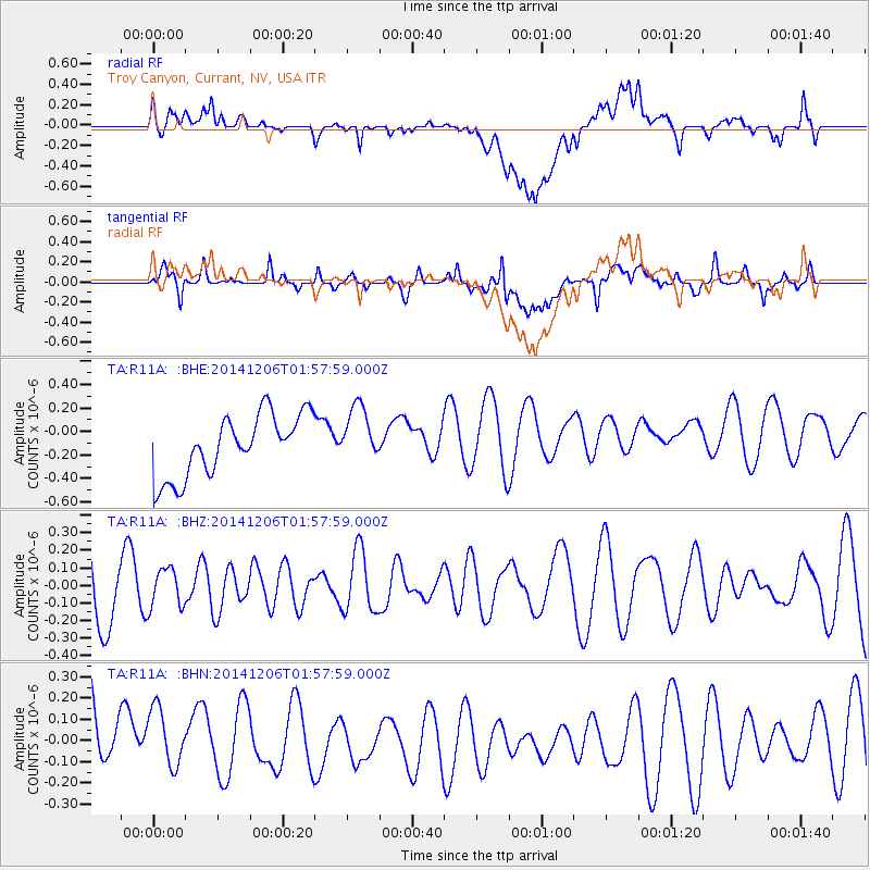
R11A Troy Canyon, Currant, NV, USA - Earthquake Result Viewer
*The percent match for this event was below the threshold and hence no stack was calculated.
| Earthquake location: |
Aegean Sea |
| Earthquake latitude/longitude: |
39.0/26.3 |
| Earthquake time(UTC): |
2014/12/06 (340) 01:45:07 GMT |
| Earthquake Depth: |
16 km |
| Earthquake Magnitude: |
5.1 MW, 5.3 mb, 4.4 MS |
| Earthquake Catalog/Contributor: |
ISC/ISC |
|
| Network: |
TA USArray Transportable Network (new EarthScope stations) |
| Station: |
R11A Troy Canyon, Currant, NV, USA |
| Lat/Lon: |
38.35 N/115.59 W |
| Elevation: |
1756 m |
|
| Distance: |
95.4 deg |
| Az: |
330.808 deg |
| Baz: |
28.908 deg |
| Ray Param: |
$rayparam |
*The percent match for this event was below the threshold and hence was not used in the summary stack. |
|
| Radial Match: |
43.93041 % |
| Radial Bump: |
400 |
| Transverse Match: |
45.196297 % |
| Transverse Bump: |
400 |
| SOD ConfigId: |
3390531 |
| Insert Time: |
2019-04-15 09:17:30.118 +0000 |
| GWidth: |
2.5 |
| Max Bumps: |
400 |
| Tol: |
0.001 |
|
Signal To Noise
| Channel | StoN | STA | LTA |
| TA:R11A: :BHZ:20141206T01:57:59.000Z | 0.4923302 | 1.1031093E-7 | 2.2405884E-7 |
| TA:R11A: :BHN:20141206T01:57:59.000Z | 0.6838148 | 1.8614766E-7 | 2.722194E-7 |
| TA:R11A: :BHE:20141206T01:57:59.000Z | 0.957196 | 2.5006585E-7 | 2.6124832E-7 |
| Arrivals |
| Ps | |
| PpPs | |
| PsPs/PpSs | |


