You are here: Home > Network List > TA - USArray Transportable Network (new EarthScope stations) Stations List
> Station H17A Grant Village (NPS), Yellowstone Nt. Park, WY, USA > Earthquake Result Viewer
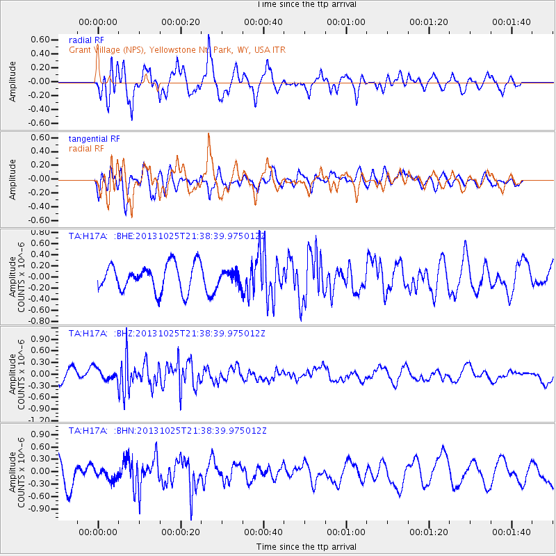
H17A Grant Village (NPS), Yellowstone Nt. Park, WY, USA - Earthquake Result Viewer
*The percent match for this event was below the threshold and hence no stack was calculated.
| Earthquake location: |
Off East Coast Of Honshu, Japan |
| Earthquake latitude/longitude: |
37.1/144.7 |
| Earthquake time(UTC): |
2013/10/25 (298) 21:27:34 GMT |
| Earthquake Depth: |
10 km |
| Earthquake Magnitude: |
5.5 MB, 5.8 MWC |
| Earthquake Catalog/Contributor: |
NEIC PDE/NEIC COMCAT |
|
| Network: |
TA USArray Transportable Network (new EarthScope stations) |
| Station: |
H17A Grant Village (NPS), Yellowstone Nt. Park, WY, USA |
| Lat/Lon: |
44.40 N/110.58 W |
| Elevation: |
2400 m |
|
| Distance: |
74.2 deg |
| Az: |
46.103 deg |
| Baz: |
306.524 deg |
| Ray Param: |
$rayparam |
*The percent match for this event was below the threshold and hence was not used in the summary stack. |
|
| Radial Match: |
80.67516 % |
| Radial Bump: |
400 |
| Transverse Match: |
49.126705 % |
| Transverse Bump: |
400 |
| SOD ConfigId: |
626651 |
| Insert Time: |
2014-04-19 07:03:12.553 +0000 |
| GWidth: |
2.5 |
| Max Bumps: |
400 |
| Tol: |
0.001 |
|
Signal To Noise
| Channel | StoN | STA | LTA |
| TA:H17A: :BHZ:20131025T21:38:39.975012Z | 0.6633234 | 1.4052222E-7 | 2.1184572E-7 |
| TA:H17A: :BHN:20131025T21:38:39.975012Z | 0.5038153 | 1.17041786E-7 | 2.323109E-7 |
| TA:H17A: :BHE:20131025T21:38:39.975012Z | 0.48809028 | 1.17328916E-7 | 2.4038363E-7 |
| Arrivals |
| Ps | |
| PpPs | |
| PsPs/PpSs | |


