You are here: Home > Network List > TA - USArray Transportable Network (new EarthScope stations) Stations List
> Station Q51A Peebles, OH, USA > Earthquake Result Viewer
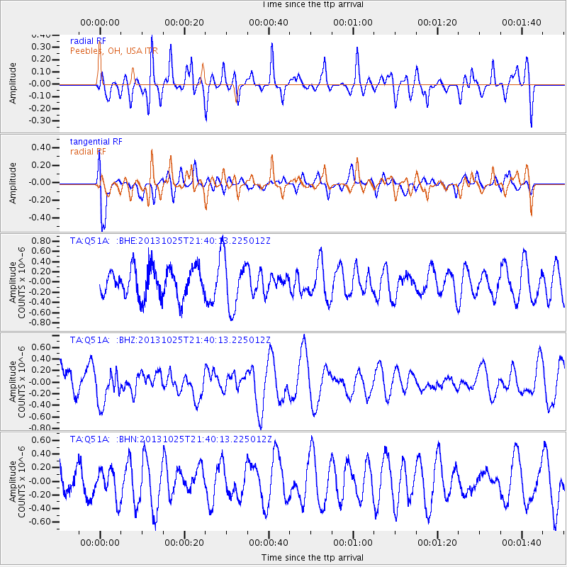
Q51A Peebles, OH, USA - Earthquake Result Viewer
*The percent match for this event was below the threshold and hence no stack was calculated.
| Earthquake location: |
Off East Coast Of Honshu, Japan |
| Earthquake latitude/longitude: |
37.1/144.7 |
| Earthquake time(UTC): |
2013/10/25 (298) 21:27:34 GMT |
| Earthquake Depth: |
10 km |
| Earthquake Magnitude: |
5.5 MB, 5.8 MWC |
| Earthquake Catalog/Contributor: |
NEIC PDE/NEIC COMCAT |
|
| Network: |
TA USArray Transportable Network (new EarthScope stations) |
| Station: |
Q51A Peebles, OH, USA |
| Lat/Lon: |
39.03 N/83.35 W |
| Elevation: |
362 m |
|
| Distance: |
92.3 deg |
| Az: |
35.413 deg |
| Baz: |
323.505 deg |
| Ray Param: |
$rayparam |
*The percent match for this event was below the threshold and hence was not used in the summary stack. |
|
| Radial Match: |
53.76332 % |
| Radial Bump: |
394 |
| Transverse Match: |
75.484795 % |
| Transverse Bump: |
400 |
| SOD ConfigId: |
626651 |
| Insert Time: |
2014-04-19 07:07:05.564 +0000 |
| GWidth: |
2.5 |
| Max Bumps: |
400 |
| Tol: |
0.001 |
|
Signal To Noise
| Channel | StoN | STA | LTA |
| TA:Q51A: :BHZ:20131025T21:40:13.225012Z | 0.9699783 | 2.899437E-7 | 2.989177E-7 |
| TA:Q51A: :BHN:20131025T21:40:13.225012Z | 1.1973362 | 2.2185698E-7 | 1.8529214E-7 |
| TA:Q51A: :BHE:20131025T21:40:13.225012Z | 1.7907636 | 4.985489E-7 | 2.7840017E-7 |
| Arrivals |
| Ps | |
| PpPs | |
| PsPs/PpSs | |


