You are here: Home > Network List > TJ - Tajikistan National Seismic Network Stations List
> Station GARM Garm, Tajikistan > Earthquake Result Viewer
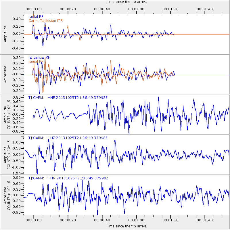
GARM Garm, Tajikistan - Earthquake Result Viewer
*The percent match for this event was below the threshold and hence no stack was calculated.
| Earthquake location: |
Off East Coast Of Honshu, Japan |
| Earthquake latitude/longitude: |
37.1/144.7 |
| Earthquake time(UTC): |
2013/10/25 (298) 21:27:34 GMT |
| Earthquake Depth: |
10 km |
| Earthquake Magnitude: |
5.5 MB, 5.8 MWC |
| Earthquake Catalog/Contributor: |
NEIC PDE/NEIC COMCAT |
|
| Network: |
TJ Tajikistan National Seismic Network |
| Station: |
GARM Garm, Tajikistan |
| Lat/Lon: |
39.00 N/70.32 E |
| Elevation: |
1305 m |
|
| Distance: |
57.0 deg |
| Az: |
296.546 deg |
| Baz: |
66.612 deg |
| Ray Param: |
$rayparam |
*The percent match for this event was below the threshold and hence was not used in the summary stack. |
|
| Radial Match: |
71.99893 % |
| Radial Bump: |
400 |
| Transverse Match: |
69.449745 % |
| Transverse Bump: |
400 |
| SOD ConfigId: |
626651 |
| Insert Time: |
2014-04-19 07:09:16.311 +0000 |
| GWidth: |
2.5 |
| Max Bumps: |
400 |
| Tol: |
0.001 |
|
Signal To Noise
| Channel | StoN | STA | LTA |
| TJ:GARM: :HHZ:20131025T21:36:49.37998Z | 2.0651636 | 5.6684445E-7 | 2.7447922E-7 |
| TJ:GARM: :HHN:20131025T21:36:49.37998Z | 1.095803 | 1.6636668E-7 | 1.518217E-7 |
| TJ:GARM: :HHE:20131025T21:36:49.37998Z | 1.5776045 | 2.3375706E-7 | 1.4817215E-7 |
| Arrivals |
| Ps | |
| PpPs | |
| PsPs/PpSs | |


