You are here: Home > Network List > CN - Canadian National Seismograph Network Stations List
> Station INK INUVIK, NT > Earthquake Result Viewer
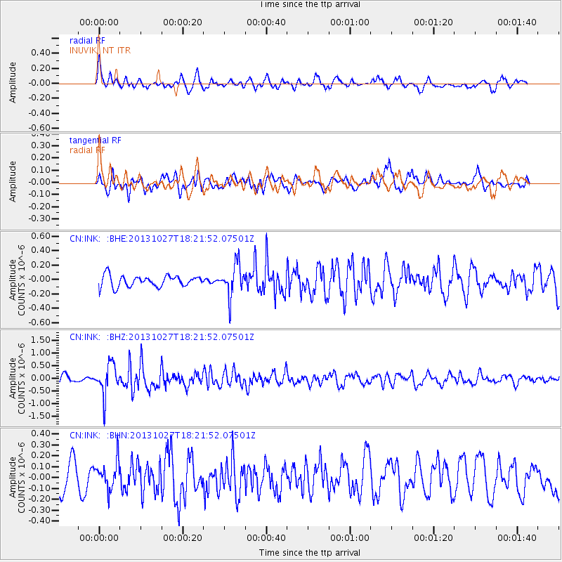
INK INUVIK, NT - Earthquake Result Viewer
*The percent match for this event was below the threshold and hence no stack was calculated.
| Earthquake location: |
Off East Coast Of Honshu, Japan |
| Earthquake latitude/longitude: |
37.1/144.6 |
| Earthquake time(UTC): |
2013/10/27 (300) 18:13:06 GMT |
| Earthquake Depth: |
20 km |
| Earthquake Magnitude: |
5.5 MWB, 5.7 MWC |
| Earthquake Catalog/Contributor: |
NEIC PDE/NEIC COMCAT |
|
| Network: |
CN Canadian National Seismograph Network |
| Station: |
INK INUVIK, NT |
| Lat/Lon: |
68.31 N/133.53 W |
| Elevation: |
44 m |
|
| Distance: |
53.2 deg |
| Az: |
27.374 deg |
| Baz: |
278.524 deg |
| Ray Param: |
$rayparam |
*The percent match for this event was below the threshold and hence was not used in the summary stack. |
|
| Radial Match: |
75.55743 % |
| Radial Bump: |
400 |
| Transverse Match: |
55.05849 % |
| Transverse Bump: |
400 |
| SOD ConfigId: |
626651 |
| Insert Time: |
2014-04-19 07:22:39.526 +0000 |
| GWidth: |
2.5 |
| Max Bumps: |
400 |
| Tol: |
0.001 |
|
Signal To Noise
| Channel | StoN | STA | LTA |
| CN:INK: :BHZ:20131027T18:21:52.07501Z | 3.7590468 | 6.198683E-7 | 1.649004E-7 |
| CN:INK: :BHN:20131027T18:21:52.07501Z | 1.0519142 | 1.2853248E-7 | 1.2218912E-7 |
| CN:INK: :BHE:20131027T18:21:52.07501Z | 2.9376857 | 2.2725295E-7 | 7.735782E-8 |
| Arrivals |
| Ps | |
| PpPs | |
| PsPs/PpSs | |


