You are here: Home > Network List > IC - New China Digital Seismograph Network Stations List
> Station WMQ Urumqi, Xinjiang Province, China > Earthquake Result Viewer
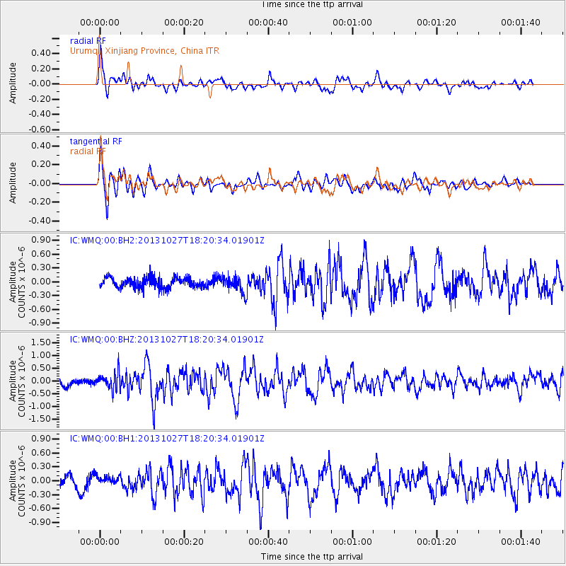
WMQ Urumqi, Xinjiang Province, China - Earthquake Result Viewer
*The percent match for this event was below the threshold and hence no stack was calculated.
| Earthquake location: |
Off East Coast Of Honshu, Japan |
| Earthquake latitude/longitude: |
37.1/144.6 |
| Earthquake time(UTC): |
2013/10/27 (300) 18:13:06 GMT |
| Earthquake Depth: |
20 km |
| Earthquake Magnitude: |
5.5 MWB, 5.7 MWC |
| Earthquake Catalog/Contributor: |
NEIC PDE/NEIC COMCAT |
|
| Network: |
IC New China Digital Seismograph Network |
| Station: |
WMQ Urumqi, Xinjiang Province, China |
| Lat/Lon: |
43.81 N/87.70 E |
| Elevation: |
850 m |
|
| Distance: |
43.1 deg |
| Az: |
297.39 deg |
| Baz: |
78.754 deg |
| Ray Param: |
$rayparam |
*The percent match for this event was below the threshold and hence was not used in the summary stack. |
|
| Radial Match: |
74.41386 % |
| Radial Bump: |
400 |
| Transverse Match: |
78.44751 % |
| Transverse Bump: |
400 |
| SOD ConfigId: |
626651 |
| Insert Time: |
2014-04-19 07:26:09.235 +0000 |
| GWidth: |
2.5 |
| Max Bumps: |
400 |
| Tol: |
0.001 |
|
Signal To Noise
| Channel | StoN | STA | LTA |
| IC:WMQ:00:BHZ:20131027T18:20:34.01901Z | 1.8917797 | 3.3764982E-7 | 1.7848264E-7 |
| IC:WMQ:00:BH1:20131027T18:20:34.01901Z | 0.645139 | 8.6873335E-8 | 1.3465832E-7 |
| IC:WMQ:00:BH2:20131027T18:20:34.01901Z | 1.604513 | 1.7994839E-7 | 1.121514E-7 |
| Arrivals |
| Ps | |
| PpPs | |
| PsPs/PpSs | |


