TLY Talaya, Russia - Earthquake Result Viewer
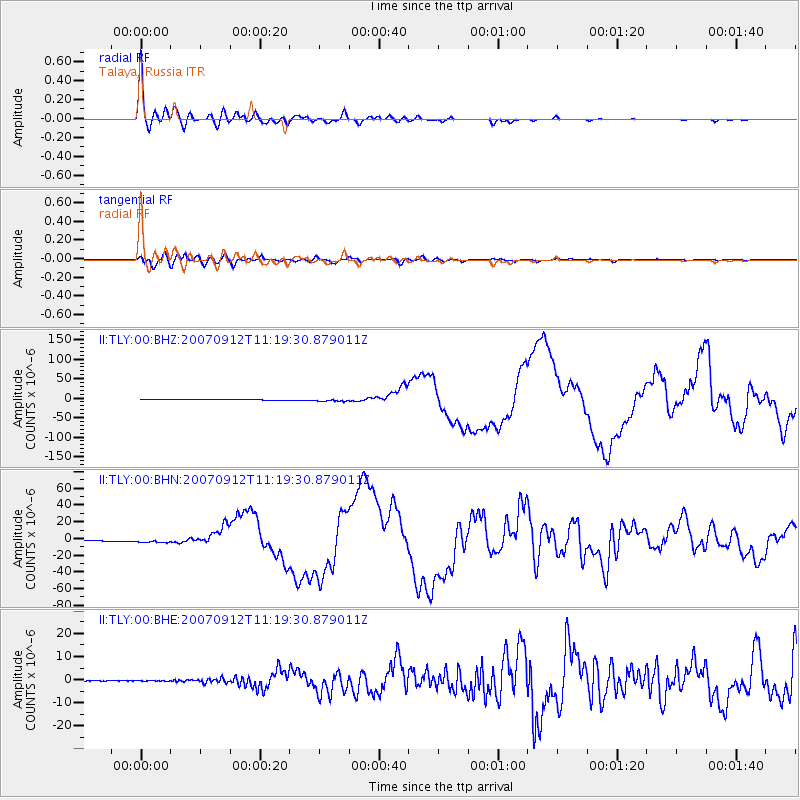
Earthquake location: Southern Sumatra, Indonesia
Earthquake latitude/longitude: -4.4/101.4
Earthquake time(UTC): 2007/09/12 (255) 11:10:26 GMT
Earthquake Depth: 34 km
Earthquake Magnitude: 6.9 MB, 8.5 MS, 8.4 MW, 8.0 ME
Earthquake Catalog/Contributor: WHDF/NEIC
Network: II Global Seismograph Network (GSN - IRIS/IDA)
Station: TLY Talaya, Russia
Lat/Lon: 51.68 N/103.64 E
Elevation: 579 m
Distance: 55.9 deg
Az: 1.711 deg
Baz: 182.741 deg
Ray Param: 0.06440727
Estimated Moho Depth: 48.0 km
Estimated Crust Vp/Vs: 1.71
Assumed Crust Vp: 6.419 km/s
Estimated Crust Vs: 3.754 km/s
Estimated Crust Poisson's Ratio: 0.24
Radial Match: 98.50731 %
Radial Bump: 400
Transverse Match: 91.71647 %
Transverse Bump: 400
SOD ConfigId: 2564
Insert Time: 2010-03-01 17:34:02.927 +0000
GWidth: 2.5
Max Bumps: 400
Tol: 0.001

Signal To Noise

ChannelStoNSTALTA
II:TLY:00:BHN:20070912T11:19:30.879011Z4.89644962.3864548E-64.8738474E-7
II:TLY:00:BHE:20070912T11:19:30.879011Z5.676191.416907E-72.496229E-8
II:TLY:00:BHZ:20070912T11:19:30.879011Z4.1353123.5894634E-68.68003E-7
Arrivals
Ps5.6 SECOND
PpPs19 SECOND
PsPs/PpSs25 SECOND