You are here: Home > Network List > IU - Global Seismograph Network (GSN - IRIS/USGS) Stations List
> Station RSSD Black Hills, South Dakota, USA > Earthquake Result Viewer
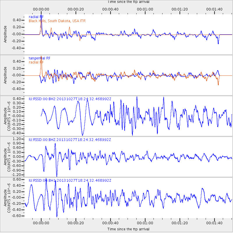
RSSD Black Hills, South Dakota, USA - Earthquake Result Viewer
*The percent match for this event was below the threshold and hence no stack was calculated.
| Earthquake location: |
Off East Coast Of Honshu, Japan |
| Earthquake latitude/longitude: |
37.1/144.6 |
| Earthquake time(UTC): |
2013/10/27 (300) 18:13:06 GMT |
| Earthquake Depth: |
20 km |
| Earthquake Magnitude: |
5.5 MWB, 5.7 MWC |
| Earthquake Catalog/Contributor: |
NEIC PDE/NEIC COMCAT |
|
| Network: |
IU Global Seismograph Network (GSN - IRIS/USGS) |
| Station: |
RSSD Black Hills, South Dakota, USA |
| Lat/Lon: |
44.12 N/104.04 W |
| Elevation: |
2090 m |
|
| Distance: |
78.1 deg |
| Az: |
43.264 deg |
| Baz: |
310.449 deg |
| Ray Param: |
$rayparam |
*The percent match for this event was below the threshold and hence was not used in the summary stack. |
|
| Radial Match: |
59.4289 % |
| Radial Bump: |
400 |
| Transverse Match: |
52.317112 % |
| Transverse Bump: |
400 |
| SOD ConfigId: |
626651 |
| Insert Time: |
2014-04-19 07:27:43.807 +0000 |
| GWidth: |
2.5 |
| Max Bumps: |
400 |
| Tol: |
0.001 |
|
Signal To Noise
| Channel | StoN | STA | LTA |
| IU:RSSD:00:BHZ:20131027T18:24:32.468992Z | 2.5478172 | 4.1765898E-7 | 1.6392815E-7 |
| IU:RSSD:00:BH1:20131027T18:24:32.468992Z | 1.339594 | 2.6015132E-7 | 1.9420163E-7 |
| IU:RSSD:00:BH2:20131027T18:24:32.468992Z | 0.58342254 | 1.0664658E-7 | 1.8279475E-7 |
| Arrivals |
| Ps | |
| PpPs | |
| PsPs/PpSs | |


