You are here: Home > Network List > IW - Intermountain West Stations List
> Station DLMT Dillon, Montana, USA > Earthquake Result Viewer
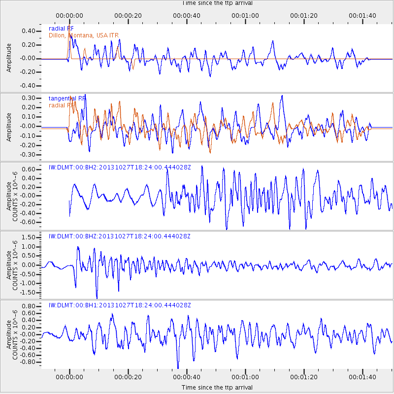
DLMT Dillon, Montana, USA - Earthquake Result Viewer
*The percent match for this event was below the threshold and hence no stack was calculated.
| Earthquake location: |
Off East Coast Of Honshu, Japan |
| Earthquake latitude/longitude: |
37.1/144.6 |
| Earthquake time(UTC): |
2013/10/27 (300) 18:13:06 GMT |
| Earthquake Depth: |
20 km |
| Earthquake Magnitude: |
5.5 MWB, 5.7 MWC |
| Earthquake Catalog/Contributor: |
NEIC PDE/NEIC COMCAT |
|
| Network: |
IW Intermountain West |
| Station: |
DLMT Dillon, Montana, USA |
| Lat/Lon: |
45.36 N/112.60 W |
| Elevation: |
1569 m |
|
| Distance: |
72.5 deg |
| Az: |
46.116 deg |
| Baz: |
305.163 deg |
| Ray Param: |
$rayparam |
*The percent match for this event was below the threshold and hence was not used in the summary stack. |
|
| Radial Match: |
62.804737 % |
| Radial Bump: |
400 |
| Transverse Match: |
70.02744 % |
| Transverse Bump: |
400 |
| SOD ConfigId: |
626651 |
| Insert Time: |
2014-04-19 07:28:01.274 +0000 |
| GWidth: |
2.5 |
| Max Bumps: |
400 |
| Tol: |
0.001 |
|
Signal To Noise
| Channel | StoN | STA | LTA |
| IW:DLMT:00:BHZ:20131027T18:24:00.444028Z | 3.1529596 | 4.879384E-7 | 1.5475568E-7 |
| IW:DLMT:00:BH1:20131027T18:24:00.444028Z | 0.8176457 | 1.0886795E-7 | 1.3314808E-7 |
| IW:DLMT:00:BH2:20131027T18:24:00.444028Z | 1.7995292 | 2.4931444E-7 | 1.3854427E-7 |
| Arrivals |
| Ps | |
| PpPs | |
| PsPs/PpSs | |


