You are here: Home > Network List > TA - USArray Transportable Network (new EarthScope stations) Stations List
> Station K22A Casper, WY, USA > Earthquake Result Viewer
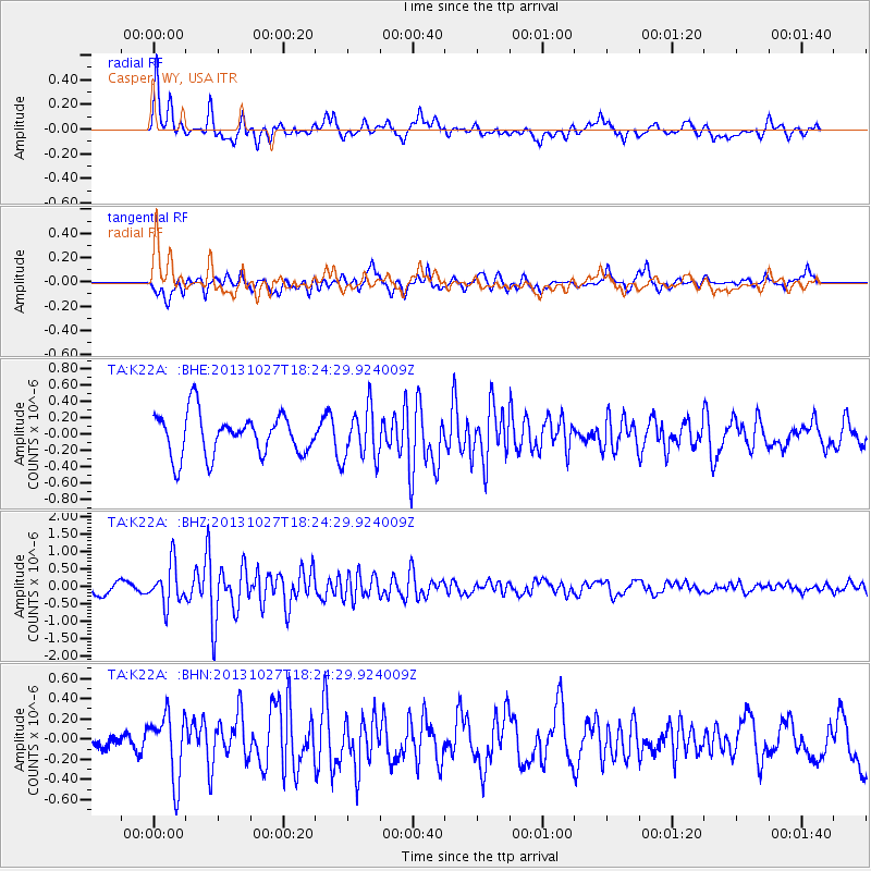
K22A Casper, WY, USA - Earthquake Result Viewer
*The percent match for this event was below the threshold and hence no stack was calculated.
| Earthquake location: |
Off East Coast Of Honshu, Japan |
| Earthquake latitude/longitude: |
37.1/144.6 |
| Earthquake time(UTC): |
2013/10/27 (300) 18:13:06 GMT |
| Earthquake Depth: |
20 km |
| Earthquake Magnitude: |
5.5 MWB, 5.7 MWC |
| Earthquake Catalog/Contributor: |
NEIC PDE/NEIC COMCAT |
|
| Network: |
TA USArray Transportable Network (new EarthScope stations) |
| Station: |
K22A Casper, WY, USA |
| Lat/Lon: |
42.65 N/106.52 W |
| Elevation: |
1686 m |
|
| Distance: |
77.6 deg |
| Az: |
45.607 deg |
| Baz: |
309.239 deg |
| Ray Param: |
$rayparam |
*The percent match for this event was below the threshold and hence was not used in the summary stack. |
|
| Radial Match: |
70.70182 % |
| Radial Bump: |
400 |
| Transverse Match: |
68.92265 % |
| Transverse Bump: |
400 |
| SOD ConfigId: |
626651 |
| Insert Time: |
2014-04-19 07:39:16.726 +0000 |
| GWidth: |
2.5 |
| Max Bumps: |
400 |
| Tol: |
0.001 |
|
Signal To Noise
| Channel | StoN | STA | LTA |
| TA:K22A: :BHZ:20131027T18:24:29.924009Z | 2.773904 | 5.789809E-7 | 2.0872419E-7 |
| TA:K22A: :BHN:20131027T18:24:29.924009Z | 3.0816047 | 3.1912776E-7 | 1.0355896E-7 |
| TA:K22A: :BHE:20131027T18:24:29.924009Z | 1.2369964 | 3.1270372E-7 | 2.5279274E-7 |
| Arrivals |
| Ps | |
| PpPs | |
| PsPs/PpSs | |


