You are here: Home > Network List > TA - USArray Transportable Network (new EarthScope stations) Stations List
> Station N47A Urbana, IN, USA > Earthquake Result Viewer
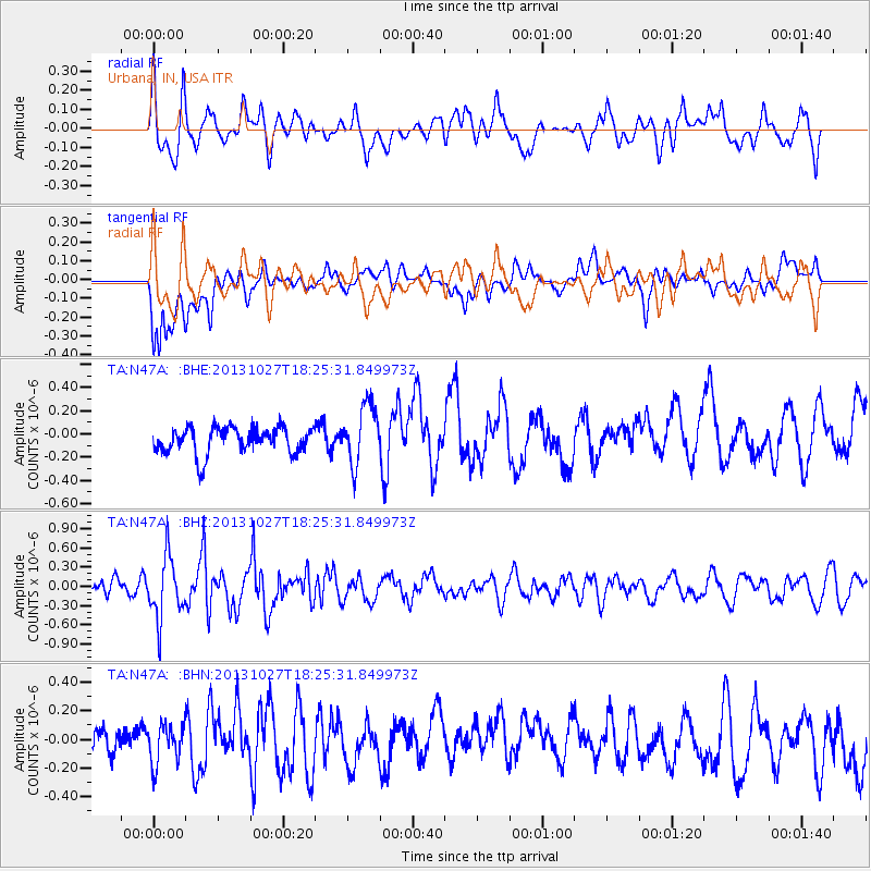
N47A Urbana, IN, USA - Earthquake Result Viewer
*The percent match for this event was below the threshold and hence no stack was calculated.
| Earthquake location: |
Off East Coast Of Honshu, Japan |
| Earthquake latitude/longitude: |
37.1/144.6 |
| Earthquake time(UTC): |
2013/10/27 (300) 18:13:06 GMT |
| Earthquake Depth: |
20 km |
| Earthquake Magnitude: |
5.5 MWB, 5.7 MWC |
| Earthquake Catalog/Contributor: |
NEIC PDE/NEIC COMCAT |
|
| Network: |
TA USArray Transportable Network (new EarthScope stations) |
| Station: |
N47A Urbana, IN, USA |
| Lat/Lon: |
40.88 N/85.69 W |
| Elevation: |
252 m |
|
| Distance: |
89.8 deg |
| Az: |
35.671 deg |
| Baz: |
322.05 deg |
| Ray Param: |
$rayparam |
*The percent match for this event was below the threshold and hence was not used in the summary stack. |
|
| Radial Match: |
62.035107 % |
| Radial Bump: |
400 |
| Transverse Match: |
51.55075 % |
| Transverse Bump: |
400 |
| SOD ConfigId: |
626651 |
| Insert Time: |
2014-04-19 07:41:01.173 +0000 |
| GWidth: |
2.5 |
| Max Bumps: |
400 |
| Tol: |
0.001 |
|
Signal To Noise
| Channel | StoN | STA | LTA |
| TA:N47A: :BHZ:20131027T18:25:31.849973Z | 3.595436 | 4.8500124E-7 | 1.3489358E-7 |
| TA:N47A: :BHN:20131027T18:25:31.849973Z | 0.81688154 | 1.3797629E-7 | 1.6890611E-7 |
| TA:N47A: :BHE:20131027T18:25:31.849973Z | 2.2337098 | 2.532242E-7 | 1.1336485E-7 |
| Arrivals |
| Ps | |
| PpPs | |
| PsPs/PpSs | |


