You are here: Home > Network List > TA - USArray Transportable Network (new EarthScope stations) Stations List
> Station N50A Nevada, OH, USA > Earthquake Result Viewer
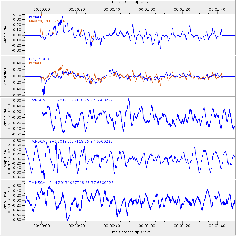
N50A Nevada, OH, USA - Earthquake Result Viewer
*The percent match for this event was below the threshold and hence no stack was calculated.
| Earthquake location: |
Off East Coast Of Honshu, Japan |
| Earthquake latitude/longitude: |
37.1/144.6 |
| Earthquake time(UTC): |
2013/10/27 (300) 18:13:06 GMT |
| Earthquake Depth: |
20 km |
| Earthquake Magnitude: |
5.5 MWB, 5.7 MWC |
| Earthquake Catalog/Contributor: |
NEIC PDE/NEIC COMCAT |
|
| Network: |
TA USArray Transportable Network (new EarthScope stations) |
| Station: |
N50A Nevada, OH, USA |
| Lat/Lon: |
40.77 N/83.15 W |
| Elevation: |
277 m |
|
| Distance: |
91.0 deg |
| Az: |
34.196 deg |
| Baz: |
323.718 deg |
| Ray Param: |
$rayparam |
*The percent match for this event was below the threshold and hence was not used in the summary stack. |
|
| Radial Match: |
54.714294 % |
| Radial Bump: |
400 |
| Transverse Match: |
60.0705 % |
| Transverse Bump: |
400 |
| SOD ConfigId: |
626651 |
| Insert Time: |
2014-04-19 07:41:06.337 +0000 |
| GWidth: |
2.5 |
| Max Bumps: |
400 |
| Tol: |
0.001 |
|
Signal To Noise
| Channel | StoN | STA | LTA |
| TA:N50A: :BHZ:20131027T18:25:37.650022Z | 1.5345469 | 5.179023E-7 | 3.3749527E-7 |
| TA:N50A: :BHN:20131027T18:25:37.650022Z | 1.6410949 | 4.233019E-7 | 2.579387E-7 |
| TA:N50A: :BHE:20131027T18:25:37.650022Z | 0.6139775 | 1.6538353E-7 | 2.6936416E-7 |
| Arrivals |
| Ps | |
| PpPs | |
| PsPs/PpSs | |


