You are here: Home > Network List > TA - USArray Transportable Network (new EarthScope stations) Stations List
> Station X43A Marvell, AR, USA > Earthquake Result Viewer
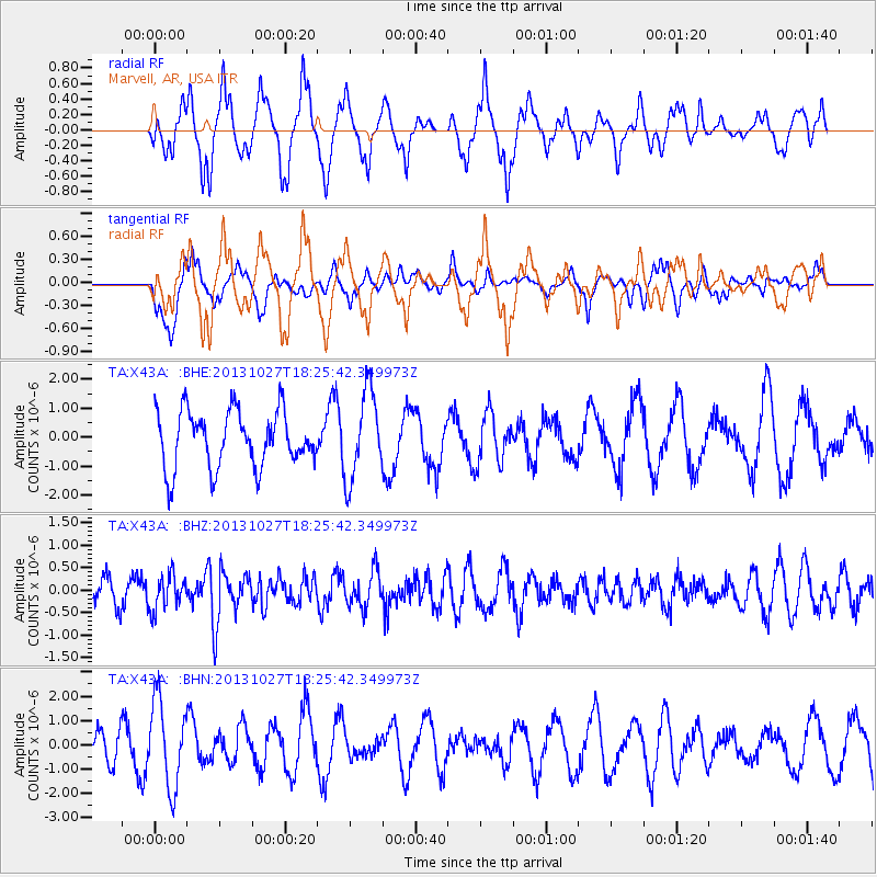
X43A Marvell, AR, USA - Earthquake Result Viewer
*The percent match for this event was below the threshold and hence no stack was calculated.
| Earthquake location: |
Off East Coast Of Honshu, Japan |
| Earthquake latitude/longitude: |
37.1/144.6 |
| Earthquake time(UTC): |
2013/10/27 (300) 18:13:06 GMT |
| Earthquake Depth: |
20 km |
| Earthquake Magnitude: |
5.5 MWB, 5.7 MWC |
| Earthquake Catalog/Contributor: |
NEIC PDE/NEIC COMCAT |
|
| Network: |
TA USArray Transportable Network (new EarthScope stations) |
| Station: |
X43A Marvell, AR, USA |
| Lat/Lon: |
34.52 N/90.88 W |
| Elevation: |
53 m |
|
| Distance: |
92.0 deg |
| Az: |
42.887 deg |
| Baz: |
318.77 deg |
| Ray Param: |
$rayparam |
*The percent match for this event was below the threshold and hence was not used in the summary stack. |
|
| Radial Match: |
59.208992 % |
| Radial Bump: |
366 |
| Transverse Match: |
46.614887 % |
| Transverse Bump: |
361 |
| SOD ConfigId: |
626651 |
| Insert Time: |
2014-04-19 07:44:30.757 +0000 |
| GWidth: |
2.5 |
| Max Bumps: |
400 |
| Tol: |
0.001 |
|
Signal To Noise
| Channel | StoN | STA | LTA |
| TA:X43A: :BHZ:20131027T18:25:42.349973Z | 1.2591116 | 3.8722305E-7 | 3.075367E-7 |
| TA:X43A: :BHN:20131027T18:25:42.349973Z | 3.1972008 | 1.7714322E-6 | 5.540572E-7 |
| TA:X43A: :BHE:20131027T18:25:42.349973Z | 1.5594764 | 1.5108608E-6 | 9.688257E-7 |
| Arrivals |
| Ps | |
| PpPs | |
| PsPs/PpSs | |


