You are here: Home > Network List > TA - USArray Transportable Network (new EarthScope stations) Stations List
> Station X54A Belton, SC, USA > Earthquake Result Viewer
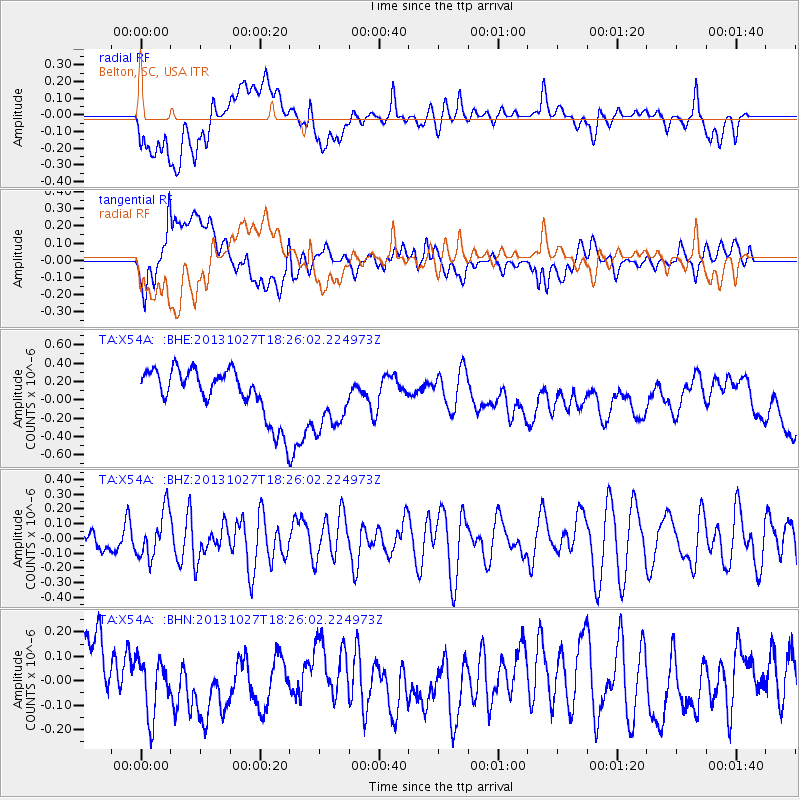
X54A Belton, SC, USA - Earthquake Result Viewer
*The percent match for this event was below the threshold and hence no stack was calculated.
| Earthquake location: |
Off East Coast Of Honshu, Japan |
| Earthquake latitude/longitude: |
37.1/144.6 |
| Earthquake time(UTC): |
2013/10/27 (300) 18:13:06 GMT |
| Earthquake Depth: |
20 km |
| Earthquake Magnitude: |
5.5 MWB, 5.7 MWC |
| Earthquake Catalog/Contributor: |
NEIC PDE/NEIC COMCAT |
|
| Network: |
TA USArray Transportable Network (new EarthScope stations) |
| Station: |
X54A Belton, SC, USA |
| Lat/Lon: |
34.55 N/82.37 W |
| Elevation: |
213 m |
|
| Distance: |
96.4 deg |
| Az: |
37.37 deg |
| Baz: |
323.984 deg |
| Ray Param: |
$rayparam |
*The percent match for this event was below the threshold and hence was not used in the summary stack. |
|
| Radial Match: |
33.735466 % |
| Radial Bump: |
400 |
| Transverse Match: |
30.083387 % |
| Transverse Bump: |
400 |
| SOD ConfigId: |
626651 |
| Insert Time: |
2014-04-19 07:44:36.741 +0000 |
| GWidth: |
2.5 |
| Max Bumps: |
400 |
| Tol: |
0.001 |
|
Signal To Noise
| Channel | StoN | STA | LTA |
| TA:X54A: :BHZ:20131027T18:26:02.224973Z | 0.88559777 | 1.57137E-7 | 1.7743608E-7 |
| TA:X54A: :BHN:20131027T18:26:02.224973Z | 0.98324364 | 1.17593345E-7 | 1.1959736E-7 |
| TA:X54A: :BHE:20131027T18:26:02.224973Z | 1.3585283 | 3.499012E-7 | 2.57559E-7 |
| Arrivals |
| Ps | |
| PpPs | |
| PsPs/PpSs | |


