You are here: Home > Network List > US - United States National Seismic Network Stations List
> Station DGMT Dagmar, Montana, USA > Earthquake Result Viewer
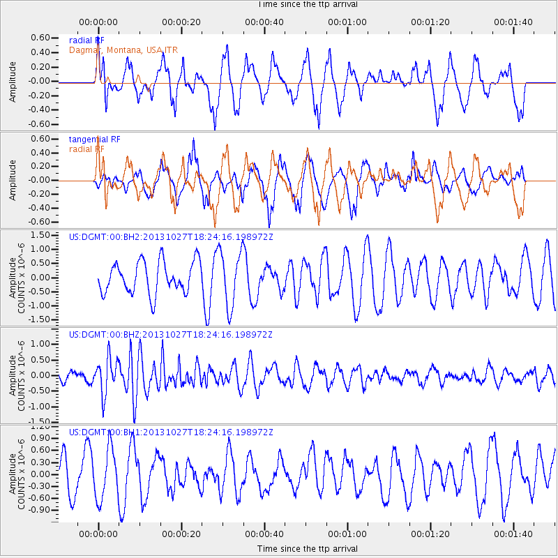
DGMT Dagmar, Montana, USA - Earthquake Result Viewer
*The percent match for this event was below the threshold and hence no stack was calculated.
| Earthquake location: |
Off East Coast Of Honshu, Japan |
| Earthquake latitude/longitude: |
37.1/144.6 |
| Earthquake time(UTC): |
2013/10/27 (300) 18:13:06 GMT |
| Earthquake Depth: |
20 km |
| Earthquake Magnitude: |
5.5 MWB, 5.7 MWC |
| Earthquake Catalog/Contributor: |
NEIC PDE/NEIC COMCAT |
|
| Network: |
US United States National Seismic Network |
| Station: |
DGMT Dagmar, Montana, USA |
| Lat/Lon: |
48.47 N/104.20 W |
| Elevation: |
0.0 m |
|
| Distance: |
75.2 deg |
| Az: |
39.913 deg |
| Baz: |
309.56 deg |
| Ray Param: |
$rayparam |
*The percent match for this event was below the threshold and hence was not used in the summary stack. |
|
| Radial Match: |
49.65409 % |
| Radial Bump: |
400 |
| Transverse Match: |
60.680794 % |
| Transverse Bump: |
400 |
| SOD ConfigId: |
626651 |
| Insert Time: |
2014-04-19 07:45:46.899 +0000 |
| GWidth: |
2.5 |
| Max Bumps: |
400 |
| Tol: |
0.001 |
|
Signal To Noise
| Channel | StoN | STA | LTA |
| US:DGMT:00:BHZ:20131027T18:24:16.198972Z | 2.5933108 | 5.799305E-7 | 2.236255E-7 |
| US:DGMT:00:BH1:20131027T18:24:16.198972Z | 1.689108 | 6.44709E-7 | 3.8168608E-7 |
| US:DGMT:00:BH2:20131027T18:24:16.198972Z | 1.7642264 | 9.861878E-7 | 5.5899164E-7 |
| Arrivals |
| Ps | |
| PpPs | |
| PsPs/PpSs | |


