You are here: Home > Network List > PF - Volcanologic Network of Piton de Fournaise-OVPF Stations List
> Station HIM cratere Himiltrude > Earthquake Result Viewer
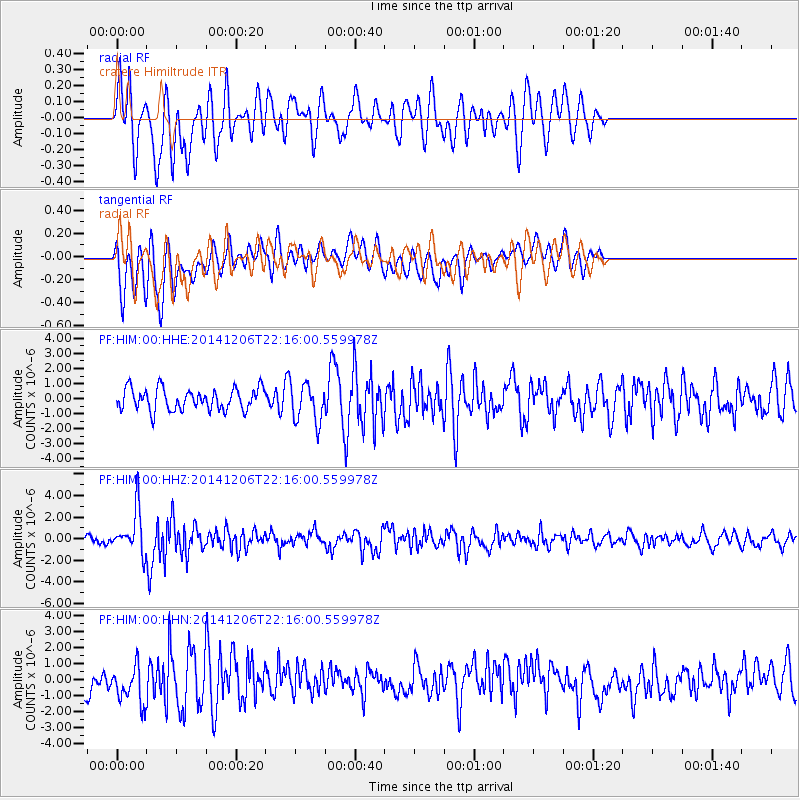
HIM cratere Himiltrude - Earthquake Result Viewer
*The percent match for this event was below the threshold and hence no stack was calculated.
| Earthquake location: |
Banda Sea |
| Earthquake latitude/longitude: |
-6.1/130.5 |
| Earthquake time(UTC): |
2014/12/06 (340) 22:05:10 GMT |
| Earthquake Depth: |
117 km |
| Earthquake Magnitude: |
6.0 MB |
| Earthquake Catalog/Contributor: |
NEIC PDE/NEIC COMCAT |
|
| Network: |
PF Volcanologic Network of Piton de Fournaise-OVPF |
| Station: |
HIM cratere Himiltrude |
| Lat/Lon: |
21.21 S/55.72 E |
| Elevation: |
1958 m |
|
| Distance: |
73.6 deg |
| Az: |
249.774 deg |
| Baz: |
90.286 deg |
| Ray Param: |
$rayparam |
*The percent match for this event was below the threshold and hence was not used in the summary stack. |
|
| Radial Match: |
65.52122 % |
| Radial Bump: |
400 |
| Transverse Match: |
63.052647 % |
| Transverse Bump: |
400 |
| SOD ConfigId: |
3390531 |
| Insert Time: |
2019-04-15 09:34:56.610 +0000 |
| GWidth: |
2.5 |
| Max Bumps: |
400 |
| Tol: |
0.001 |
|
Signal To Noise
| Channel | StoN | STA | LTA |
| PF:HIM:00:HHZ:20141206T22:16:00.559978Z | 4.751438 | 2.0314897E-6 | 4.275526E-7 |
| PF:HIM:00:HHN:20141206T22:16:00.559978Z | 1.5950398 | 1.1894261E-6 | 7.457031E-7 |
| PF:HIM:00:HHE:20141206T22:16:00.559978Z | 1.8641948 | 1.3346474E-6 | 7.159378E-7 |
| Arrivals |
| Ps | |
| PpPs | |
| PsPs/PpSs | |


