You are here: Home > Network List > II - Global Seismograph Network (GSN - IRIS/IDA) Stations List
> Station WRAB Tennant Creek, NT, Australia > Earthquake Result Viewer
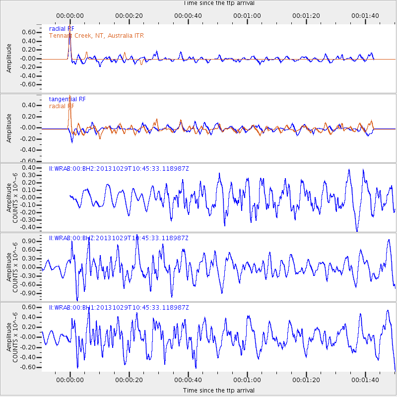
WRAB Tennant Creek, NT, Australia - Earthquake Result Viewer
*The percent match for this event was below the threshold and hence no stack was calculated.
| Earthquake location: |
Balleny Islands Region |
| Earthquake latitude/longitude: |
-61.7/154.7 |
| Earthquake time(UTC): |
2013/10/29 (302) 10:37:55 GMT |
| Earthquake Depth: |
10 km |
| Earthquake Magnitude: |
5.9 MWW, 5.9 MWB, 5.9 MWW, 6.0 MWC, 6.1 MWC |
| Earthquake Catalog/Contributor: |
NEIC PDE/NEIC COMCAT |
|
| Network: |
II Global Seismograph Network (GSN - IRIS/IDA) |
| Station: |
WRAB Tennant Creek, NT, Australia |
| Lat/Lon: |
19.93 S/134.36 E |
| Elevation: |
366 m |
|
| Distance: |
44.1 deg |
| Az: |
331.992 deg |
| Baz: |
166.237 deg |
| Ray Param: |
$rayparam |
*The percent match for this event was below the threshold and hence was not used in the summary stack. |
|
| Radial Match: |
76.21239 % |
| Radial Bump: |
400 |
| Transverse Match: |
52.691883 % |
| Transverse Bump: |
400 |
| SOD ConfigId: |
626651 |
| Insert Time: |
2014-04-19 07:54:01.534 +0000 |
| GWidth: |
2.5 |
| Max Bumps: |
400 |
| Tol: |
0.001 |
|
Signal To Noise
| Channel | StoN | STA | LTA |
| II:WRAB:00:BHZ:20131029T10:45:33.118987Z | 2.2380028 | 5.0389787E-7 | 2.2515515E-7 |
| II:WRAB:00:BH1:20131029T10:45:33.118987Z | 2.0667088 | 2.4314724E-7 | 1.1764949E-7 |
| II:WRAB:00:BH2:20131029T10:45:33.118987Z | 1.3670329 | 1.2849841E-7 | 9.399804E-8 |
| Arrivals |
| Ps | |
| PpPs | |
| PsPs/PpSs | |


