You are here: Home > Network List > IU - Global Seismograph Network (GSN - IRIS/USGS) Stations List
> Station PMG Port Moresby, New Guinea > Earthquake Result Viewer
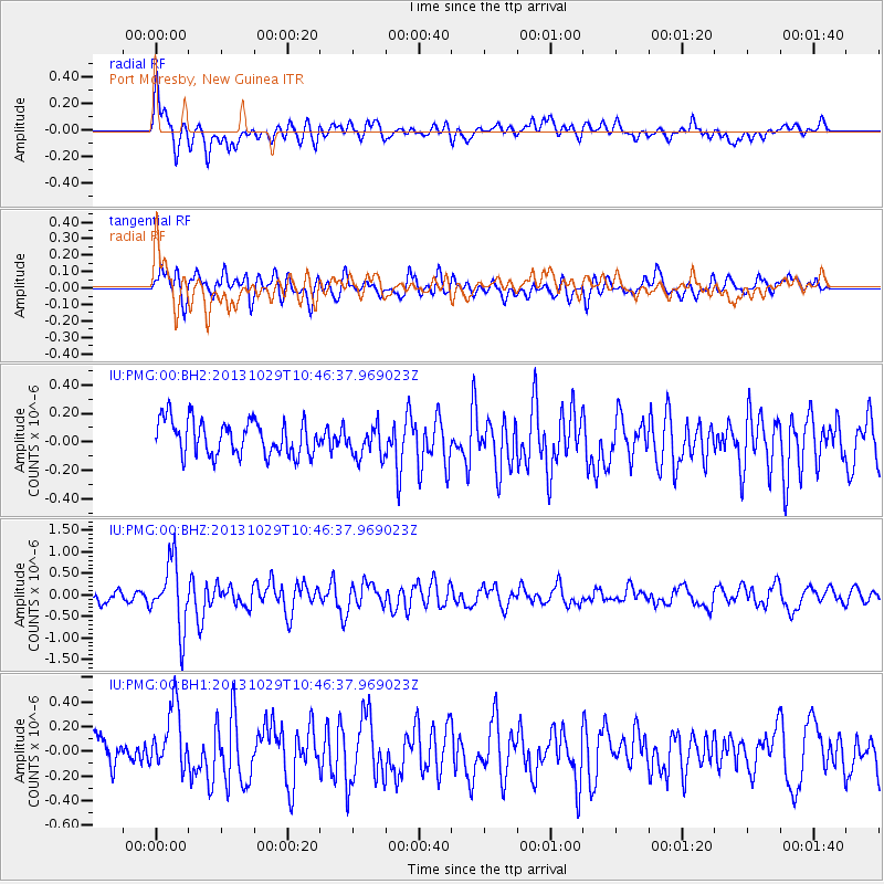
PMG Port Moresby, New Guinea - Earthquake Result Viewer
*The percent match for this event was below the threshold and hence no stack was calculated.
| Earthquake location: |
Balleny Islands Region |
| Earthquake latitude/longitude: |
-61.7/154.7 |
| Earthquake time(UTC): |
2013/10/29 (302) 10:37:55 GMT |
| Earthquake Depth: |
10 km |
| Earthquake Magnitude: |
5.9 MWW, 5.9 MWB, 5.9 MWW, 6.0 MWC, 6.1 MWC |
| Earthquake Catalog/Contributor: |
NEIC PDE/NEIC COMCAT |
|
| Network: |
IU Global Seismograph Network (GSN - IRIS/USGS) |
| Station: |
PMG Port Moresby, New Guinea |
| Lat/Lon: |
9.40 S/147.16 E |
| Elevation: |
90 m |
|
| Distance: |
52.5 deg |
| Az: |
350.637 deg |
| Baz: |
175.493 deg |
| Ray Param: |
$rayparam |
*The percent match for this event was below the threshold and hence was not used in the summary stack. |
|
| Radial Match: |
73.43031 % |
| Radial Bump: |
400 |
| Transverse Match: |
54.886314 % |
| Transverse Bump: |
400 |
| SOD ConfigId: |
626651 |
| Insert Time: |
2014-04-19 07:54:17.490 +0000 |
| GWidth: |
2.5 |
| Max Bumps: |
400 |
| Tol: |
0.001 |
|
Signal To Noise
| Channel | StoN | STA | LTA |
| IU:PMG:00:BHZ:20131029T10:46:37.969023Z | 5.2244444 | 7.734212E-7 | 1.4803894E-7 |
| IU:PMG:00:BH1:20131029T10:46:37.969023Z | 2.2858114 | 2.8672238E-7 | 1.254357E-7 |
| IU:PMG:00:BH2:20131029T10:46:37.969023Z | 0.91042596 | 1.11068616E-7 | 1.2199632E-7 |
| Arrivals |
| Ps | |
| PpPs | |
| PsPs/PpSs | |


