You are here: Home > Network List > TA - USArray Transportable Network (new EarthScope stations) Stations List
> Station Q48A North Vernon, IN, USA > Earthquake Result Viewer
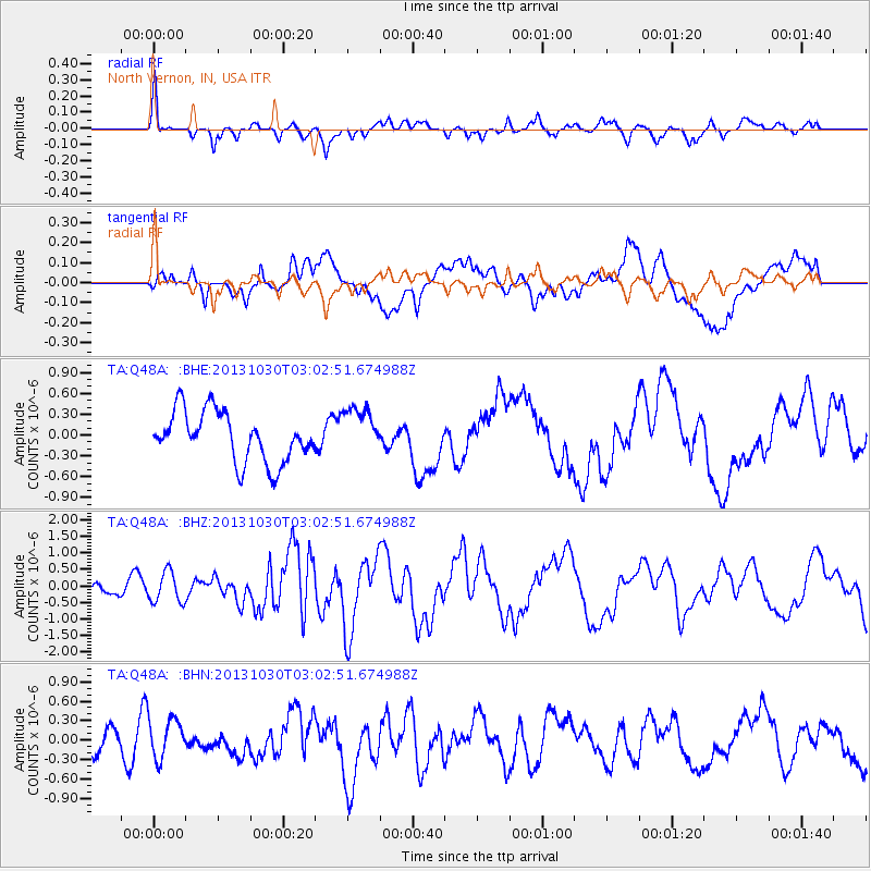
Q48A North Vernon, IN, USA - Earthquake Result Viewer
*The percent match for this event was below the threshold and hence no stack was calculated.
| Earthquake location: |
Off Coast Of Central Chile |
| Earthquake latitude/longitude: |
-35.3/-73.4 |
| Earthquake time(UTC): |
2013/10/30 (303) 02:51:47 GMT |
| Earthquake Depth: |
42 km |
| Earthquake Magnitude: |
6.2 MWW, 6.1 MWB, 6.2 MWW, 6.2 MWC, 6.3 MWC |
| Earthquake Catalog/Contributor: |
NEIC PDE/NEIC COMCAT |
|
| Network: |
TA USArray Transportable Network (new EarthScope stations) |
| Station: |
Q48A North Vernon, IN, USA |
| Lat/Lon: |
38.93 N/85.73 W |
| Elevation: |
185 m |
|
| Distance: |
74.8 deg |
| Az: |
350.054 deg |
| Baz: |
169.566 deg |
| Ray Param: |
$rayparam |
*The percent match for this event was below the threshold and hence was not used in the summary stack. |
|
| Radial Match: |
67.078575 % |
| Radial Bump: |
400 |
| Transverse Match: |
45.240086 % |
| Transverse Bump: |
400 |
| SOD ConfigId: |
626651 |
| Insert Time: |
2014-04-19 08:29:17.322 +0000 |
| GWidth: |
2.5 |
| Max Bumps: |
400 |
| Tol: |
0.001 |
|
Signal To Noise
| Channel | StoN | STA | LTA |
| TA:Q48A: :BHZ:20131030T03:02:51.674988Z | 3.2368731 | 4.599751E-7 | 1.4210477E-7 |
| TA:Q48A: :BHN:20131030T03:02:51.674988Z | 1.1981648 | 3.0881986E-7 | 2.5774406E-7 |
| TA:Q48A: :BHE:20131030T03:02:51.674988Z | 0.9634395 | 3.46874E-7 | 3.6003712E-7 |
| Arrivals |
| Ps | |
| PpPs | |
| PsPs/PpSs | |


