You are here: Home > Network List > TA - USArray Transportable Network (new EarthScope stations) Stations List
> Station T57A Hurt, VA, USA > Earthquake Result Viewer
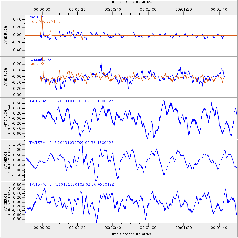
T57A Hurt, VA, USA - Earthquake Result Viewer
*The percent match for this event was below the threshold and hence no stack was calculated.
| Earthquake location: |
Off Coast Of Central Chile |
| Earthquake latitude/longitude: |
-35.3/-73.4 |
| Earthquake time(UTC): |
2013/10/30 (303) 02:51:47 GMT |
| Earthquake Depth: |
42 km |
| Earthquake Magnitude: |
6.2 MWW, 6.1 MWB, 6.2 MWW, 6.2 MWC, 6.3 MWC |
| Earthquake Catalog/Contributor: |
NEIC PDE/NEIC COMCAT |
|
| Network: |
TA USArray Transportable Network (new EarthScope stations) |
| Station: |
T57A Hurt, VA, USA |
| Lat/Lon: |
37.00 N/79.25 W |
| Elevation: |
230 m |
|
| Distance: |
72.2 deg |
| Az: |
355.075 deg |
| Baz: |
174.969 deg |
| Ray Param: |
$rayparam |
*The percent match for this event was below the threshold and hence was not used in the summary stack. |
|
| Radial Match: |
75.04688 % |
| Radial Bump: |
400 |
| Transverse Match: |
63.015125 % |
| Transverse Bump: |
400 |
| SOD ConfigId: |
626651 |
| Insert Time: |
2014-04-19 08:30:10.963 +0000 |
| GWidth: |
2.5 |
| Max Bumps: |
400 |
| Tol: |
0.001 |
|
Signal To Noise
| Channel | StoN | STA | LTA |
| TA:T57A: :BHZ:20131030T03:02:36.450012Z | 1.3056699 | 2.7486527E-7 | 2.1051667E-7 |
| TA:T57A: :BHN:20131030T03:02:36.450012Z | 1.7633793 | 3.9317243E-7 | 2.2296533E-7 |
| TA:T57A: :BHE:20131030T03:02:36.450012Z | 1.2558489 | 3.4021514E-7 | 2.709045E-7 |
| Arrivals |
| Ps | |
| PpPs | |
| PsPs/PpSs | |


