W60A Pink Hill, NC, USA - Earthquake Result Viewer
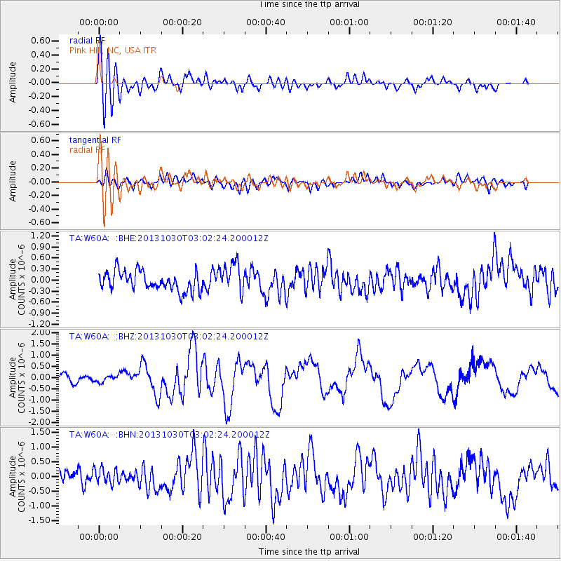
Earthquake location: Off Coast Of Central Chile
Earthquake latitude/longitude: -35.3/-73.4
Earthquake time(UTC): 2013/10/30 (303) 02:51:47 GMT
Earthquake Depth: 42 km
Earthquake Magnitude: 6.2 MWW, 6.1 MWB, 6.2 MWW, 6.2 MWC, 6.3 MWC
Earthquake Catalog/Contributor: NEIC PDE/NEIC COMCAT
Network: TA USArray Transportable Network (new EarthScope stations)
Station: W60A Pink Hill, NC, USA
Lat/Lon: 35.05 N/77.71 W
Elevation: 30 m
Distance: 70.1 deg
Az: 356.233 deg
Baz: 176.245 deg
Ray Param: 0.05511902
Estimated Moho Depth: 13.5 km
Estimated Crust Vp/Vs: 2.06
Assumed Crust Vp: 6.565 km/s
Estimated Crust Vs: 3.191 km/s
Estimated Crust Poisson's Ratio: 0.35
Radial Match: 86.33326 %
Radial Bump: 400
Transverse Match: 52.687508 %
Transverse Bump: 400
SOD ConfigId: 626651
Insert Time: 2014-04-19 08:30:51.320 +0000
GWidth: 2.5
Max Bumps: 400
Tol: 0.001

Signal To Noise

ChannelStoNSTALTA
TA:W60A: :BHZ:20131030T03:02:24.200012Z0.701589641.416116E-72.018439E-7
TA:W60A: :BHN:20131030T03:02:24.200012Z0.99050822.4736056E-72.4973096E-7
TA:W60A: :BHE:20131030T03:02:24.200012Z1.61363414.1716598E-72.5852574E-7
Arrivals
Ps2.2 SECOND
PpPs6.1 SECOND
PsPs/PpSs8.3 SECOND