You are here: Home > Network List > US - United States National Seismic Network Stations List
> Station EGMT Eagleton, Montana, USA > Earthquake Result Viewer
EGMT Eagleton, Montana, USA - Earthquake Result Viewer
*The percent match for this event was below the threshold and hence no stack was calculated.
| Earthquake location: |
Taiwan |
| Earthquake latitude/longitude: |
23.6/121.4 |
| Earthquake time(UTC): |
2013/10/31 (304) 12:02:08 GMT |
| Earthquake Depth: |
10 km |
| Earthquake Magnitude: |
6.3 MWW, 6.2 MWB, 6.3 MWW, 6.3 MWC, 6.7 MI |
| Earthquake Catalog/Contributor: |
NEIC PDE/NEIC COMCAT |
|
| Network: |
US United States National Seismic Network |
| Station: |
EGMT Eagleton, Montana, USA |
| Lat/Lon: |
48.02 N/109.75 W |
| Elevation: |
1055 m |
|
| Distance: |
95.2 deg |
| Az: |
31.687 deg |
| Baz: |
314.121 deg |
| Ray Param: |
$rayparam |
*The percent match for this event was below the threshold and hence was not used in the summary stack. |
|
| Radial Match: |
69.88381 % |
| Radial Bump: |
400 |
| Transverse Match: |
49.691093 % |
| Transverse Bump: |
400 |
| SOD ConfigId: |
626651 |
| Insert Time: |
2014-04-19 08:51:44.040 +0000 |
| GWidth: |
2.5 |
| Max Bumps: |
400 |
| Tol: |
0.001 |
|
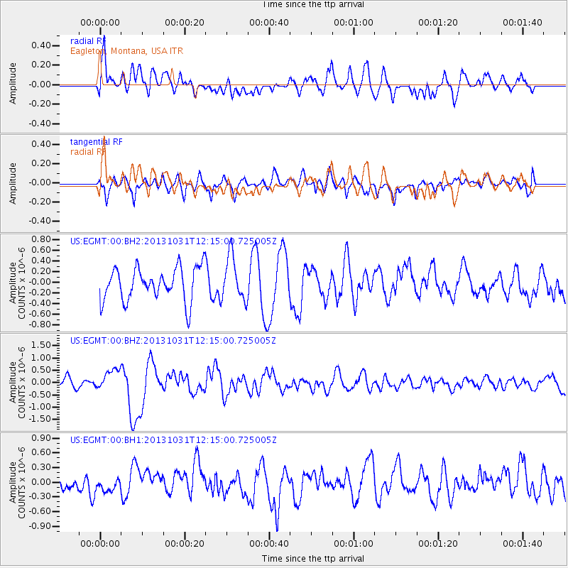
Signal To Noise
| Channel | StoN | STA | LTA |
| US:EGMT:00:BHZ:20131031T12:15:00.725005Z | 2.363773 | 4.3019793E-7 | 1.8199628E-7 |
| US:EGMT:00:BH1:20131031T12:15:00.725005Z | 0.5620118 | 9.687942E-8 | 1.723797E-7 |
| US:EGMT:00:BH2:20131031T12:15:00.725005Z | 1.3470451 | 4.187459E-7 | 3.108626E-7 |
| Arrivals |
| Ps | |
| PpPs | |
| PsPs/PpSs | |


