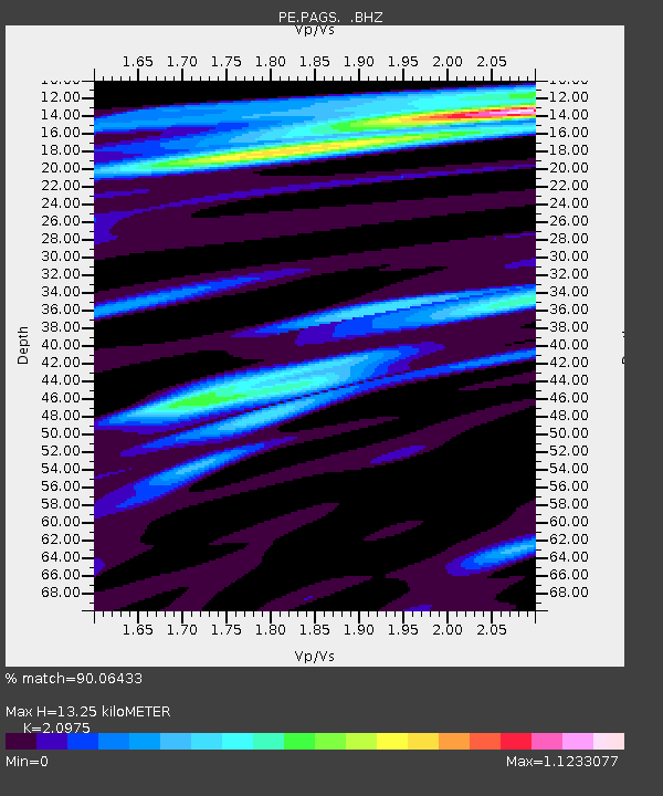
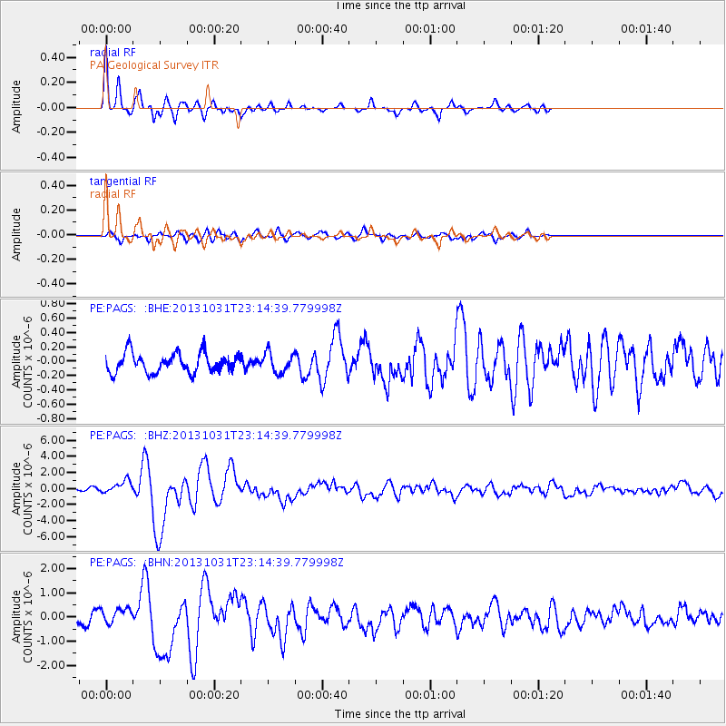
PAGS PA Geological Survey - Earthquake Result Viewer

Earthquake location: Near Coast Of Central Chile
Earthquake latitude/longitude: -30.3/-71.5
Earthquake time(UTC): 2013/10/31 (304) 23:03:59 GMT
Earthquake Depth: 27 km
Earthquake Magnitude: 6.6 MWW, 6.4 MWB, 6.5 MWC, 6.6 MWW, 6.6 MI
Earthquake Catalog/Contributor: NEIC PDE/NEIC COMCAT
Network: PE Penn State Network
Station: PAGS PA Geological Survey
Lat/Lon: 40.23 N/76.72 W
Elevation: 120 m
Distance: 70.3 deg
Az: 355.774 deg
Baz: 175.224 deg
Ray Param: 0.0550191
Estimated Moho Depth: 13.25 km
Estimated Crust Vp/Vs: 2.10
Assumed Crust Vp: 6.121 km/s
Estimated Crust Vs: 2.918 km/s
Estimated Crust Poisson's Ratio: 0.35
Radial Match: 90.06433 %
Radial Bump: 329
Transverse Match: 73.966095 %
Transverse Bump: 400
SOD ConfigId: 626651
Insert Time: 2014-04-19 09:05:49.161 +0000
GWidth: 2.5
Max Bumps: 400
Tol: 0.001

Signal To Noise

ChannelStoNSTALTA
PE:PAGS: :BHZ:20131031T23:14:39.779998Z3.054928.2836266E-72.7115692E-7
PE:PAGS: :BHN:20131031T23:14:39.779998Z1.37332953.197181E-72.328051E-7
PE:PAGS: :BHE:20131031T23:14:39.779998Z1.05396321.4058826E-71.3339009E-7
Arrivals
Ps2.4 SECOND
PpPs6.5 SECOND
PsPs/PpSs9.0 SECOND