156A Sylvania, GA, USA - Earthquake Result Viewer
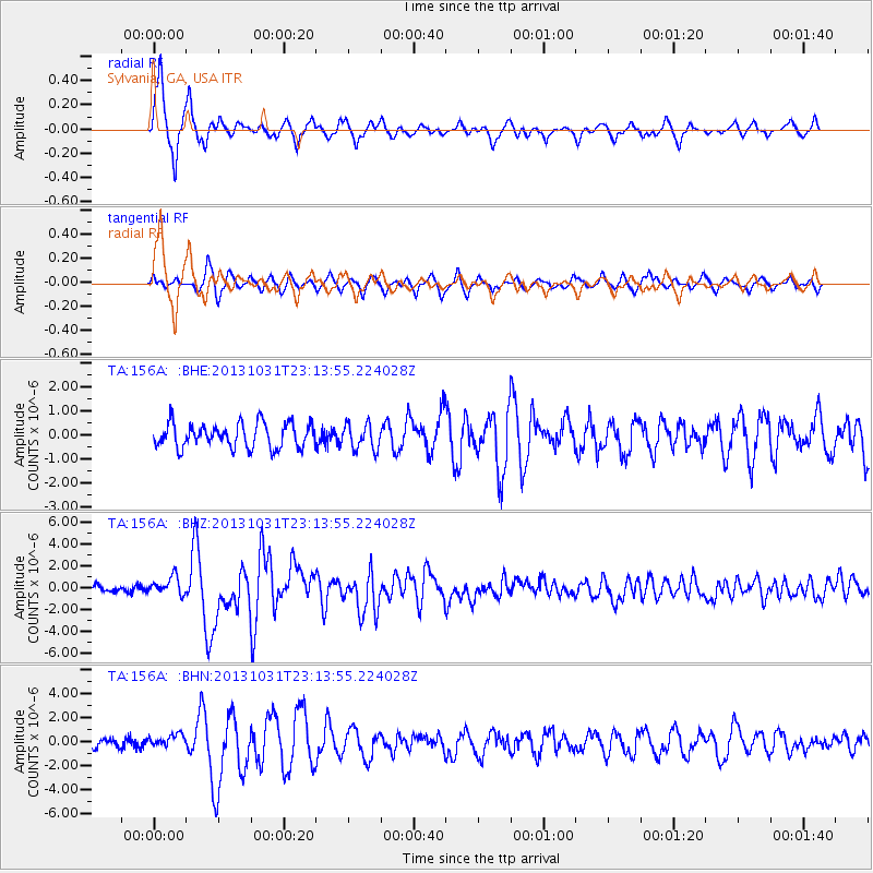
Earthquake location: Near Coast Of Central Chile
Earthquake latitude/longitude: -30.3/-71.5
Earthquake time(UTC): 2013/10/31 (304) 23:03:59 GMT
Earthquake Depth: 27 km
Earthquake Magnitude: 6.6 MWW, 6.4 MWB, 6.5 MWC, 6.6 MWW, 6.6 MI
Earthquake Catalog/Contributor: NEIC PDE/NEIC COMCAT
Network: TA USArray Transportable Network (new EarthScope stations)
Station: 156A Sylvania, GA, USA
Lat/Lon: 32.65 N/81.50 W
Elevation: 40 m
Distance: 63.3 deg
Az: 350.589 deg
Baz: 170.348 deg
Ray Param: 0.059618656
Estimated Moho Depth: 39.25 km
Estimated Crust Vp/Vs: 1.89
Assumed Crust Vp: 6.565 km/s
Estimated Crust Vs: 3.473 km/s
Estimated Crust Poisson's Ratio: 0.31
Radial Match: 92.838974 %
Radial Bump: 400
Transverse Match: 75.54887 %
Transverse Bump: 400
SOD ConfigId: 626651
Insert Time: 2014-04-19 09:08:35.930 +0000
GWidth: 2.5
Max Bumps: 400
Tol: 0.001

Signal To Noise

ChannelStoNSTALTA
TA:156A: :BHZ:20131031T23:13:55.224028Z2.78732018.1851914E-72.936581E-7
TA:156A: :BHN:20131031T23:13:55.224028Z1.0652725.422269E-75.090033E-7
TA:156A: :BHE:20131031T23:13:55.224028Z1.06372835.3585774E-75.0375434E-7
Arrivals
Ps5.6 SECOND
PpPs17 SECOND
PsPs/PpSs22 SECOND