
255A Hazlehurst, GA, USA - Earthquake Result Viewer
| ||||||||||||||||||
| ||||||||||||||||||
| ||||||||||||||||||
|
Signal To Noise
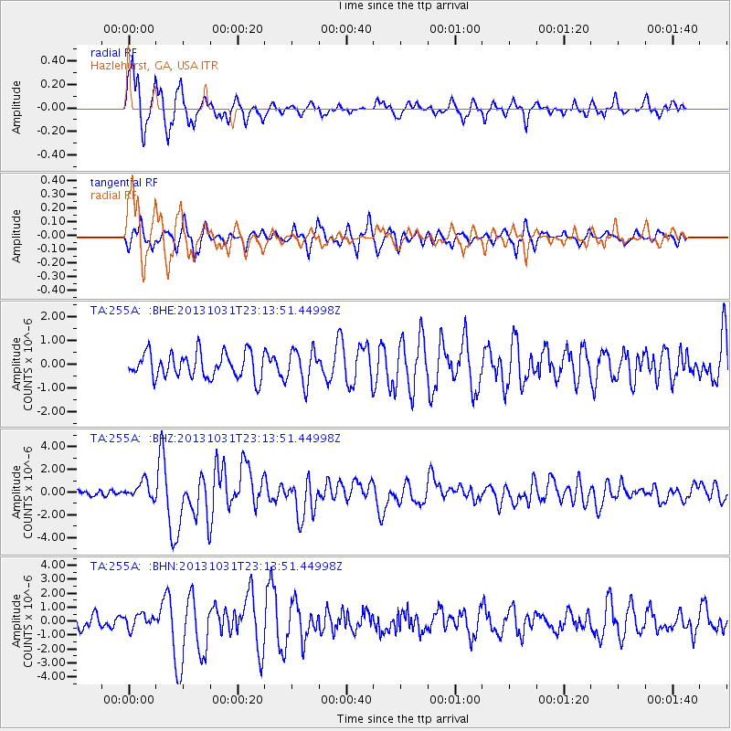
| Channel | StoN | STA | LTA |
| TA:255A: :BHZ:20131031T23:13:51.44998Z | 2.130819 | 7.5423026E-7 | 3.539626E-7 |
| TA:255A: :BHN:20131031T23:13:51.44998Z | 1.1702042 | 4.9357203E-7 | 4.2178283E-7 |
| TA:255A: :BHE:20131031T23:13:51.44998Z | 1.3369257 | 7.062058E-7 | 5.282311E-7 |
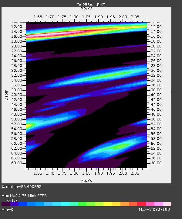
| Arrivals | |
| Ps | 1.7 SECOND |
| PpPs | 5.8 SECOND |
| PsPs/PpSs | 7.4 SECOND |

