
D41A Chassel, MI, USA - Earthquake Result Viewer
| ||||||||||||||||||
| ||||||||||||||||||
| ||||||||||||||||||
|
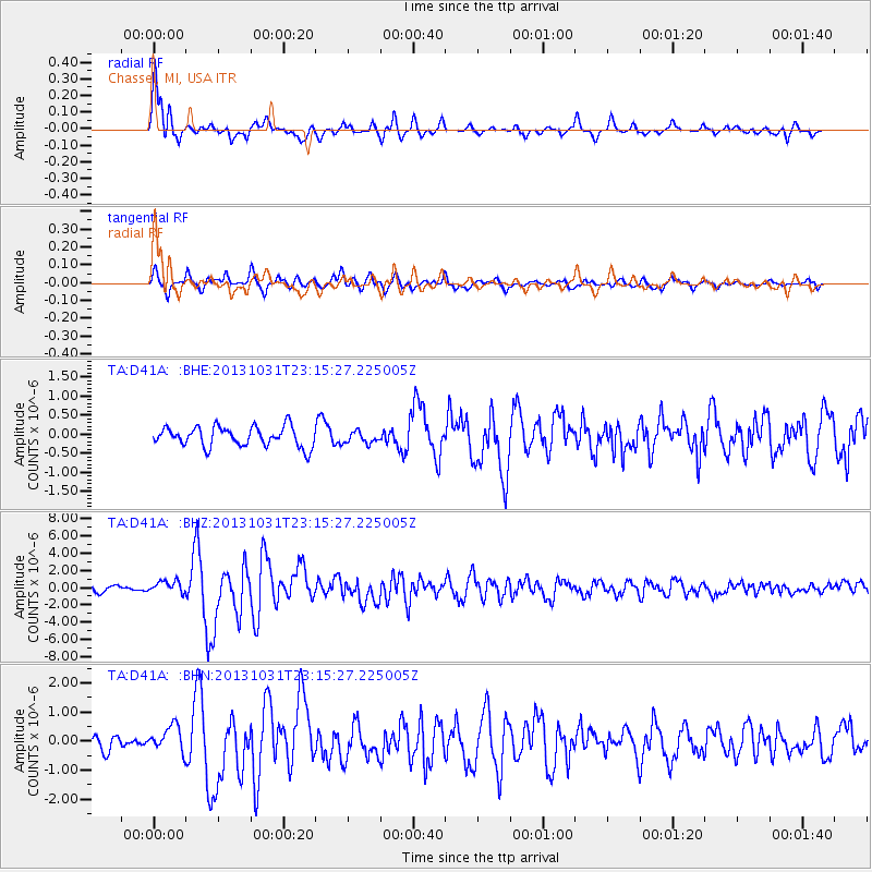
Signal To Noise
| Channel | StoN | STA | LTA |
| TA:D41A: :BHZ:20131031T23:15:27.225005Z | 1.8796355 | 7.0366707E-7 | 3.743636E-7 |
| TA:D41A: :BHN:20131031T23:15:27.225005Z | 1.3184061 | 4.4548418E-7 | 3.37896E-7 |
| TA:D41A: :BHE:20131031T23:15:27.225005Z | 0.5866156 | 1.5210344E-7 | 2.592898E-7 |
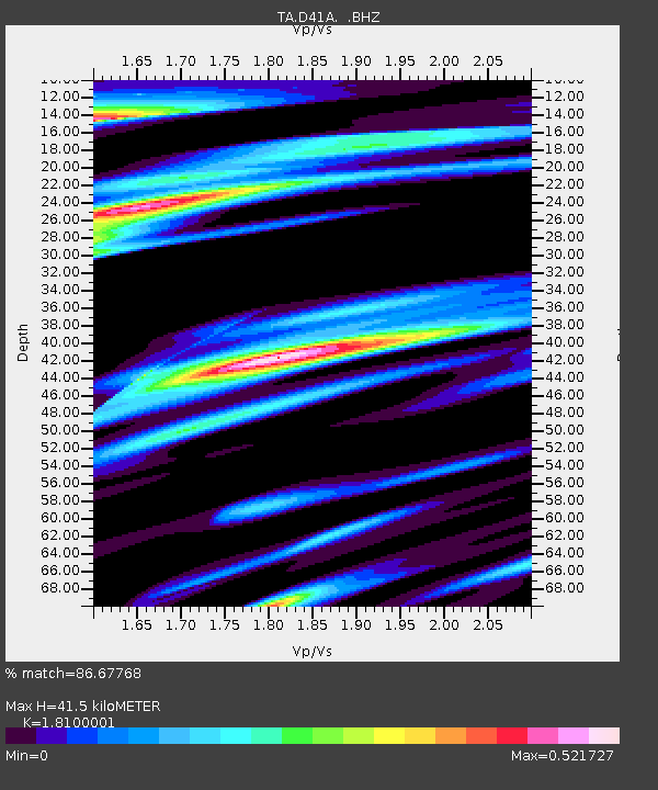
| Arrivals | |
| Ps | 5.4 SECOND |
| PpPs | 18 SECOND |
| PsPs/PpSs | 23 SECOND |

