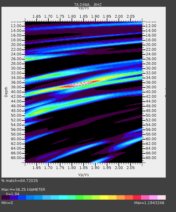
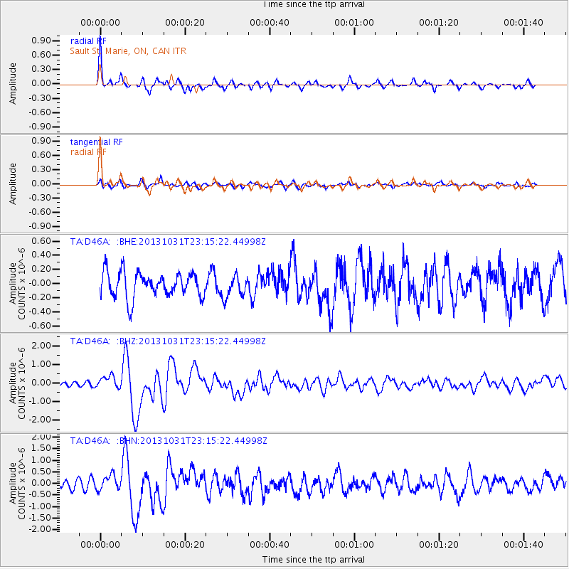
D46A Sault St. Marie, ON, CAN - Earthquake Result Viewer

Earthquake location: Near Coast Of Central Chile
Earthquake latitude/longitude: -30.3/-71.5
Earthquake time(UTC): 2013/10/31 (304) 23:03:59 GMT
Earthquake Depth: 27 km
Earthquake Magnitude: 6.6 MWW, 6.4 MWB, 6.5 MWC, 6.6 MWW, 6.6 MI
Earthquake Catalog/Contributor: NEIC PDE/NEIC COMCAT
Network: TA USArray Transportable Network (new EarthScope stations)
Station: D46A Sault St. Marie, ON, CAN
Lat/Lon: 46.89 N/84.04 W
Elevation: 353 m
Distance: 77.7 deg
Az: 351.25 deg
Baz: 168.939 deg
Ray Param: 0.050143532
Estimated Moho Depth: 36.25 km
Estimated Crust Vp/Vs: 1.84
Assumed Crust Vp: 6.467 km/s
Estimated Crust Vs: 3.514 km/s
Estimated Crust Poisson's Ratio: 0.29
Radial Match: 84.72035 %
Radial Bump: 356
Transverse Match: 72.00352 %
Transverse Bump: 400
SOD ConfigId: 626651
Insert Time: 2014-04-19 09:09:49.316 +0000
GWidth: 2.5
Max Bumps: 400
Tol: 0.001

Signal To Noise

ChannelStoNSTALTA
TA:D46A: :BHZ:20131031T23:15:22.44998Z2.44492243.3552803E-71.3723462E-7
TA:D46A: :BHN:20131031T23:15:22.44998Z1.29060163.2597268E-72.5257418E-7
TA:D46A: :BHE:20131031T23:15:22.44998Z0.86370011.5273153E-71.7683399E-7
Arrivals
Ps4.9 SECOND
PpPs15 SECOND
PsPs/PpSs20 SECOND