D51A Lot 18 Range III Mazenod Township, QC, CAN - Earthquake Result Viewer
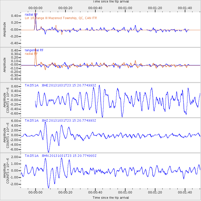
Earthquake location: Near Coast Of Central Chile
Earthquake latitude/longitude: -30.3/-71.5
Earthquake time(UTC): 2013/10/31 (304) 23:03:59 GMT
Earthquake Depth: 27 km
Earthquake Magnitude: 6.6 MWW, 6.4 MWB, 6.5 MWC, 6.6 MWW, 6.6 MI
Earthquake Catalog/Contributor: NEIC PDE/NEIC COMCAT
Network: TA USArray Transportable Network (new EarthScope stations)
Station: D51A Lot 18 Range III Mazenod Township, QC, CAN
Lat/Lon: 47.09 N/79.37 W
Elevation: 282 m
Distance: 77.3 deg
Az: 354.51 deg
Baz: 173.044 deg
Ray Param: 0.050349616
Estimated Moho Depth: 26.0 km
Estimated Crust Vp/Vs: 1.98
Assumed Crust Vp: 6.622 km/s
Estimated Crust Vs: 3.349 km/s
Estimated Crust Poisson's Ratio: 0.33
Radial Match: 87.92612 %
Radial Bump: 235
Transverse Match: 75.21167 %
Transverse Bump: 400
SOD ConfigId: 626651
Insert Time: 2014-04-19 09:09:57.653 +0000
GWidth: 2.5
Max Bumps: 400
Tol: 0.001

Signal To Noise

ChannelStoNSTALTA
TA:D51A: :BHZ:20131031T23:15:20.774993Z2.97345359.555972E-73.2137623E-7
TA:D51A: :BHN:20131031T23:15:20.774993Z1.1999413.8741624E-73.2286272E-7
TA:D51A: :BHE:20131031T23:15:20.774993Z1.60621572.871181E-71.7875438E-7
Arrivals
Ps4.0 SECOND
PpPs11 SECOND
PsPs/PpSs15 SECOND