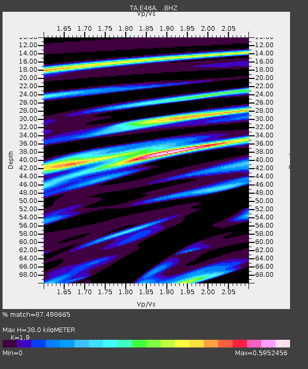
E46A Sault Ste Marie, MI, USA - Earthquake Result Viewer
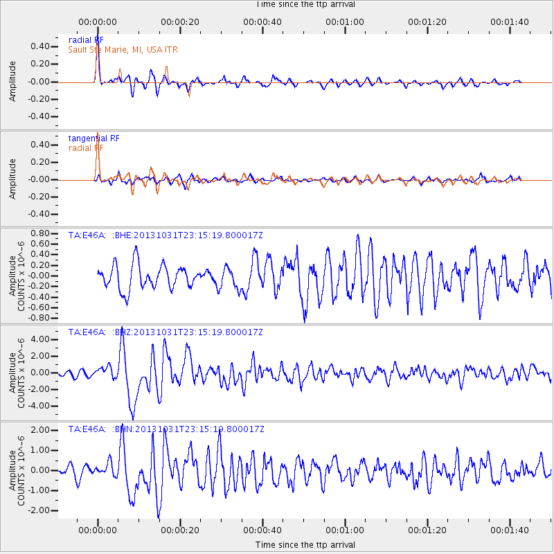
Earthquake location: Near Coast Of Central Chile
Earthquake latitude/longitude: -30.3/-71.5
Earthquake time(UTC): 2013/10/31 (304) 23:03:59 GMT
Earthquake Depth: 27 km
Earthquake Magnitude: 6.6 MWW, 6.4 MWB, 6.5 MWC, 6.6 MWW, 6.6 MI
Earthquake Catalog/Contributor: NEIC PDE/NEIC COMCAT
Network: TA USArray Transportable Network (new EarthScope stations)
Station: E46A Sault Ste Marie, MI, USA
Lat/Lon: 46.37 N/84.31 W
Elevation: 269 m
Distance: 77.2 deg
Az: 350.958 deg
Baz: 168.679 deg
Ray Param: 0.050468333
Estimated Moho Depth: 38.0 km
Estimated Crust Vp/Vs: 1.90
Assumed Crust Vp: 6.467 km/s
Estimated Crust Vs: 3.404 km/s
Estimated Crust Poisson's Ratio: 0.31
Radial Match: 87.498665 %
Radial Bump: 306
Transverse Match: 76.16034 %
Transverse Bump: 400
SOD ConfigId: 626651
Insert Time: 2014-04-19 09:10:33.426 +0000
GWidth: 2.5
Max Bumps: 400
Tol: 0.001

Signal To Noise

ChannelStoNSTALTA
TA:E46A: :BHZ:20131031T23:15:19.800017Z2.7953226.866553E-72.4564446E-7
TA:E46A: :BHN:20131031T23:15:19.800017Z1.20922463.281966E-72.7141078E-7
TA:E46A: :BHE:20131031T23:15:19.800017Z0.91290172.0504733E-72.2461052E-7
Arrivals
Ps5.4 SECOND
PpPs17 SECOND
PsPs/PpSs22 SECOND