E48A Lockeyer, ON, CAN - Earthquake Result Viewer
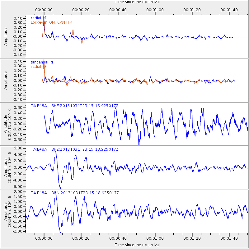
Earthquake location: Near Coast Of Central Chile
Earthquake latitude/longitude: -30.3/-71.5
Earthquake time(UTC): 2013/10/31 (304) 23:03:59 GMT
Earthquake Depth: 27 km
Earthquake Magnitude: 6.6 MWW, 6.4 MWB, 6.5 MWC, 6.6 MWW, 6.6 MI
Earthquake Catalog/Contributor: NEIC PDE/NEIC COMCAT
Network: TA USArray Transportable Network (new EarthScope stations)
Station: E48A Lockeyer, ON, CAN
Lat/Lon: 46.48 N/82.17 W
Elevation: 347 m
Distance: 77.0 deg
Az: 352.474 deg
Baz: 170.564 deg
Ray Param: 0.050571226
Estimated Moho Depth: 34.25 km
Estimated Crust Vp/Vs: 1.82
Assumed Crust Vp: 6.467 km/s
Estimated Crust Vs: 3.563 km/s
Estimated Crust Poisson's Ratio: 0.28
Radial Match: 89.635826 %
Radial Bump: 333
Transverse Match: 71.43321 %
Transverse Bump: 400
SOD ConfigId: 626651
Insert Time: 2014-04-19 09:10:36.582 +0000
GWidth: 2.5
Max Bumps: 400
Tol: 0.001

Signal To Noise

ChannelStoNSTALTA
TA:E48A: :BHZ:20131031T23:15:18.925017Z2.39515168.228745E-73.435584E-7
TA:E48A: :BHN:20131031T23:15:18.925017Z1.72565274.2376308E-72.4556684E-7
TA:E48A: :BHE:20131031T23:15:18.925017Z0.84663531.7366429E-72.0512292E-7
Arrivals
Ps4.5 SECOND
PpPs14 SECOND
PsPs/PpSs19 SECOND