
E51A G1948 Merrick Township, ON, CAN - Earthquake Result Viewer
| ||||||||||||||||||
| ||||||||||||||||||
| ||||||||||||||||||
|
Signal To Noise
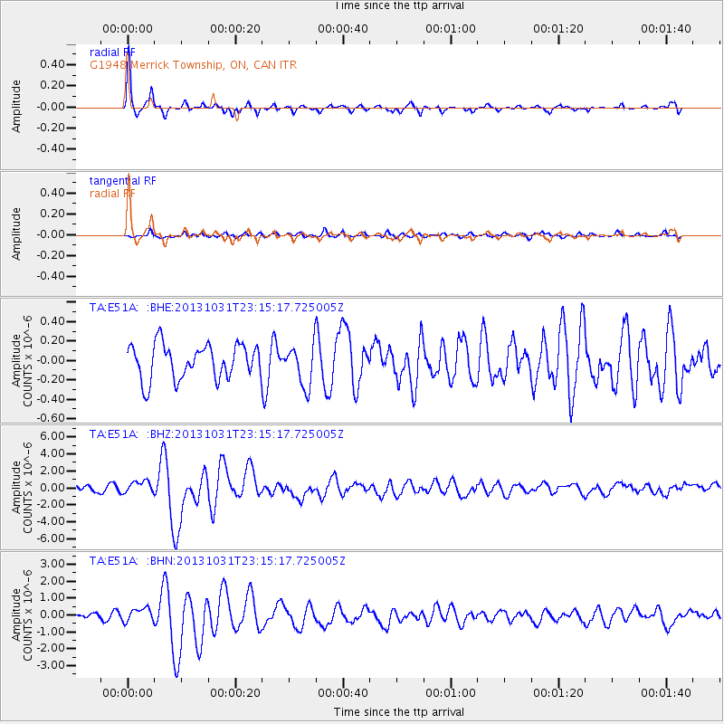
| Channel | StoN | STA | LTA |
| TA:E51A: :BHZ:20131031T23:15:17.725005Z | 2.177826 | 7.262025E-7 | 3.3345293E-7 |
| TA:E51A: :BHN:20131031T23:15:17.725005Z | 1.8034875 | 4.058186E-7 | 2.2501881E-7 |
| TA:E51A: :BHE:20131031T23:15:17.725005Z | 1.2014936 | 2.1313254E-7 | 1.7738967E-7 |
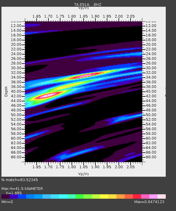
| Arrivals | |
| Ps | 4.5 SECOND |
| PpPs | 16 SECOND |
| PsPs/PpSs | 21 SECOND |

