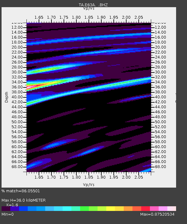
E63A Oxbow, ME, USA - Earthquake Result Viewer
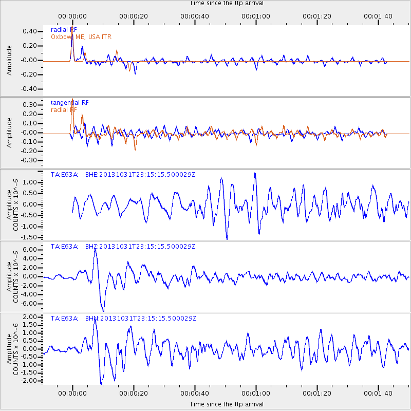
Earthquake location: Near Coast Of Central Chile
Earthquake latitude/longitude: -30.3/-71.5
Earthquake time(UTC): 2013/10/31 (304) 23:03:59 GMT
Earthquake Depth: 27 km
Earthquake Magnitude: 6.6 MWW, 6.4 MWB, 6.5 MWC, 6.6 MWW, 6.6 MI
Earthquake Catalog/Contributor: NEIC PDE/NEIC COMCAT
Network: TA USArray Transportable Network (new EarthScope stations)
Station: E63A Oxbow, ME, USA
Lat/Lon: 46.42 N/68.42 W
Elevation: 238 m
Distance: 76.4 deg
Az: 2.205 deg
Baz: 182.758 deg
Ray Param: 0.05098189
Estimated Moho Depth: 36.0 km
Estimated Crust Vp/Vs: 1.60
Assumed Crust Vp: 6.419 km/s
Estimated Crust Vs: 4.012 km/s
Estimated Crust Poisson's Ratio: 0.18
Radial Match: 86.05501 %
Radial Bump: 400
Transverse Match: 73.30248 %
Transverse Bump: 400
SOD ConfigId: 626651
Insert Time: 2014-04-19 09:11:05.053 +0000
GWidth: 2.5
Max Bumps: 400
Tol: 0.001

Signal To Noise

ChannelStoNSTALTA
TA:E63A: :BHZ:20131031T23:15:15.500029Z4.45127879.4402526E-72.1207957E-7
TA:E63A: :BHN:20131031T23:15:15.500029Z1.38775073.33929E-72.4062606E-7
TA:E63A: :BHE:20131031T23:15:15.500029Z1.319814.0638812E-73.079141E-7
Arrivals
Ps3.5 SECOND
PpPs14 SECOND
PsPs/PpSs18 SECOND